|
2024 FLUORESCENT TRIANGLE EXPLORATION FILL 5-GALLON GAS CONTAINER - MIGHT LAST 100 MILES BRING DIVE MASK, SNORKEL, SWIM FINS, REEF SHOES BUY LITTLE INFLATABLE RAFT OR MINI-KAYAK, SURFBOARD ETC TRY INFLATABLE RAFT WITH ENGINE FOR EEL RIVER? RENT JEEP?
JOURNEY'S END HOTEL & RESTAURANT- RUTH LAKE FOREST GLEN CABIN GUARD STATION
NEXT LOCATIONS?
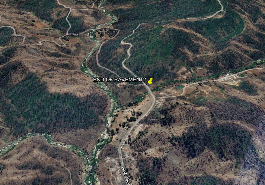
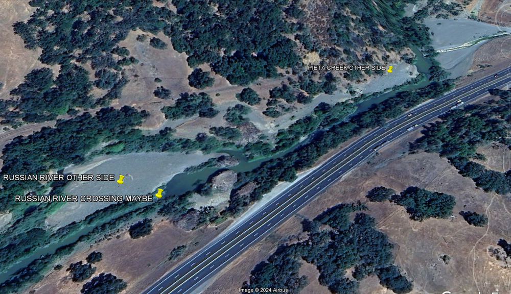
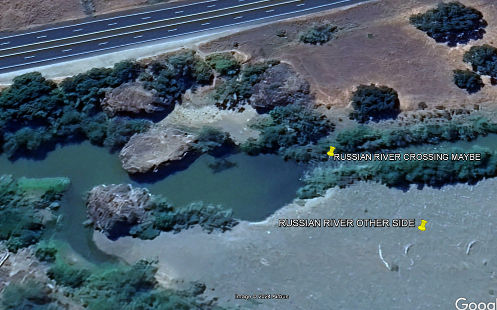
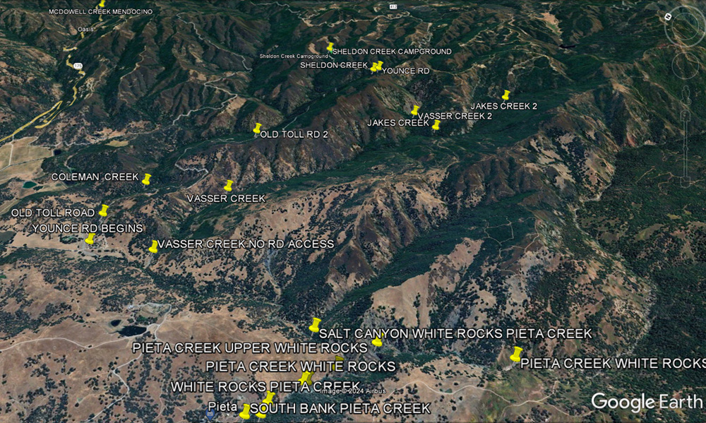
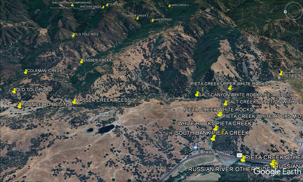
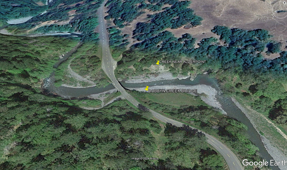
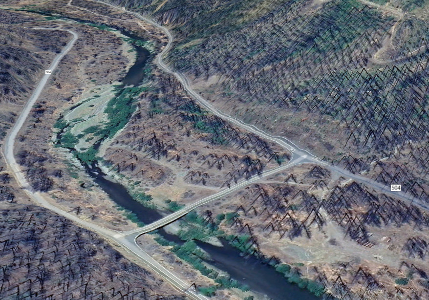
RIVER CROSSING
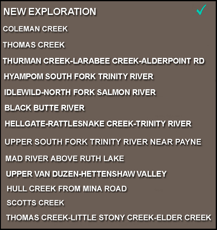
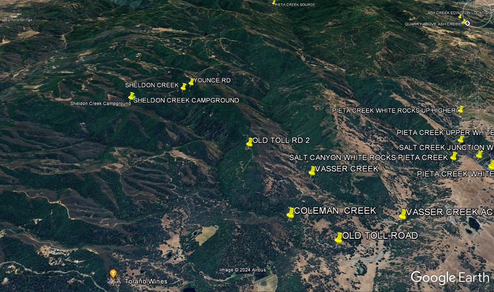
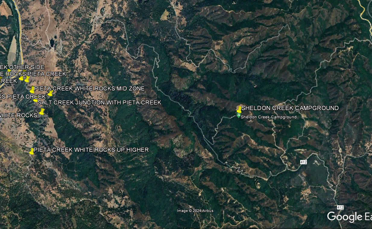
COLEMAN CREEK WATERSHED
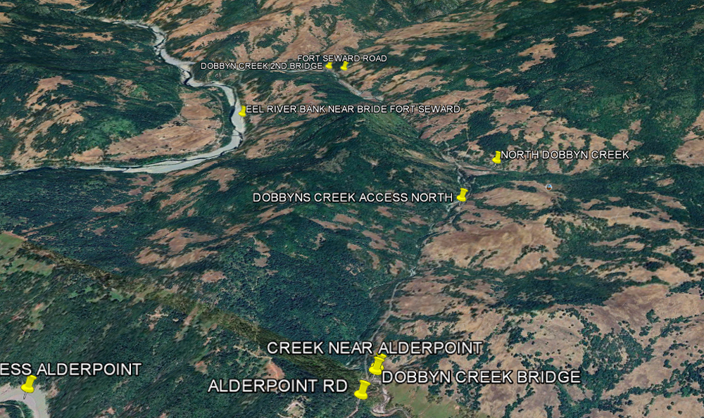
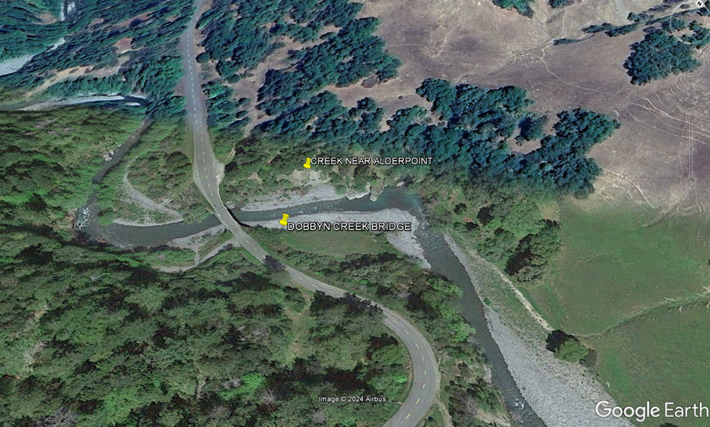
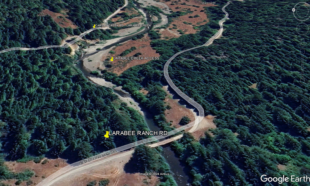
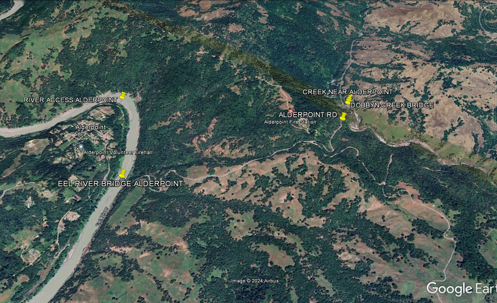
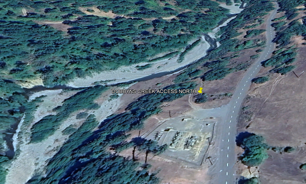
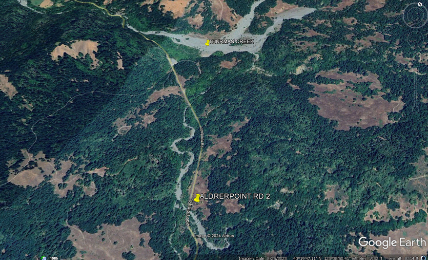
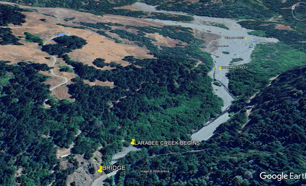
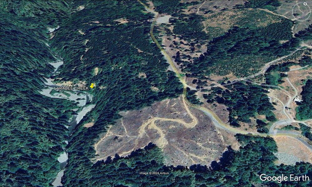
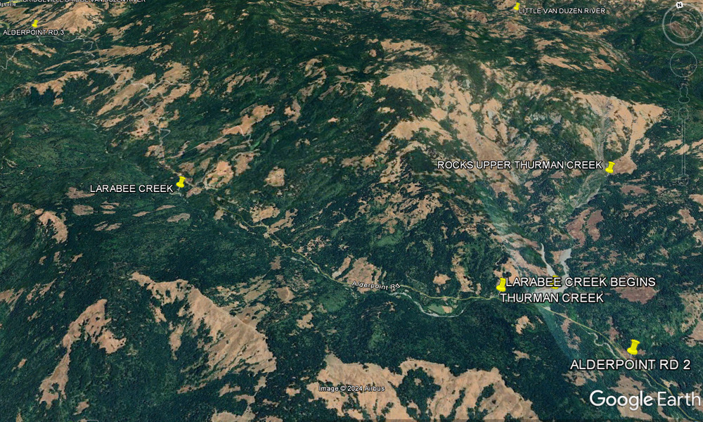
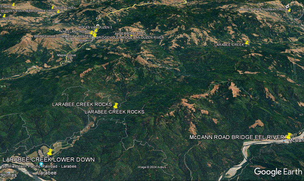
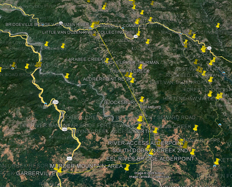
THURMAN CREEK-LARABEE CREEK-DOBBYNS CREEK ALDERPOINT- BLOCKSBURG RD
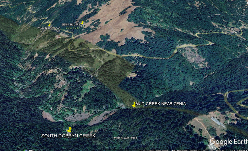
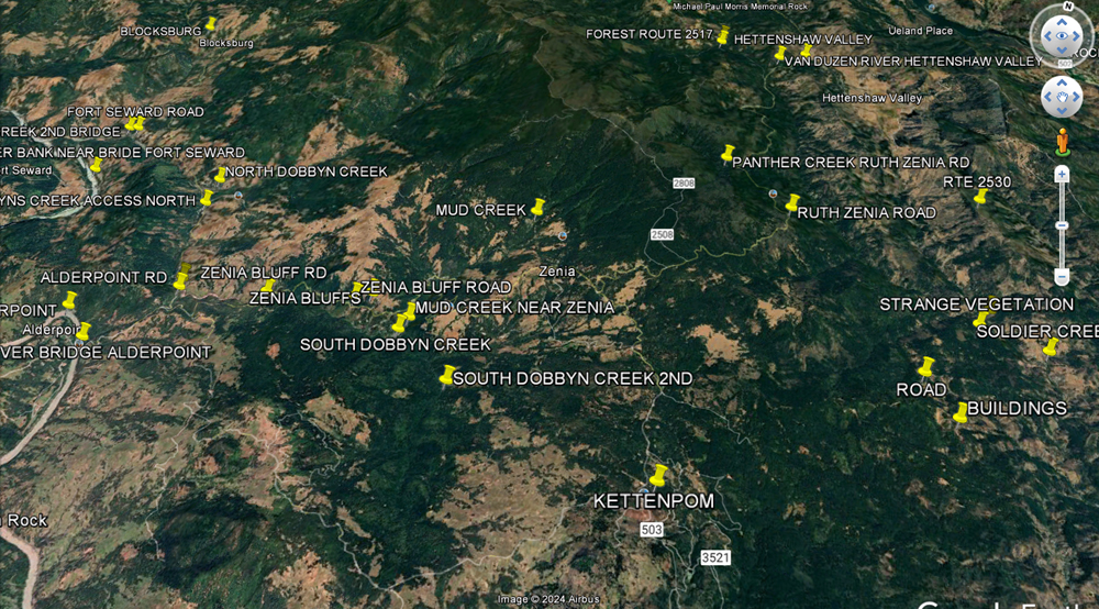
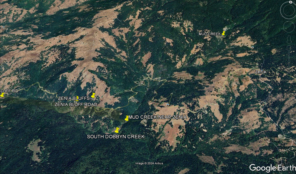
ZENIA BLUFF RD TO SOUTH DOBBYNS CREEK-MUD CREEK
ALDERPOINT ROAD-BLOCKSBURG-BRIDGEVILLE
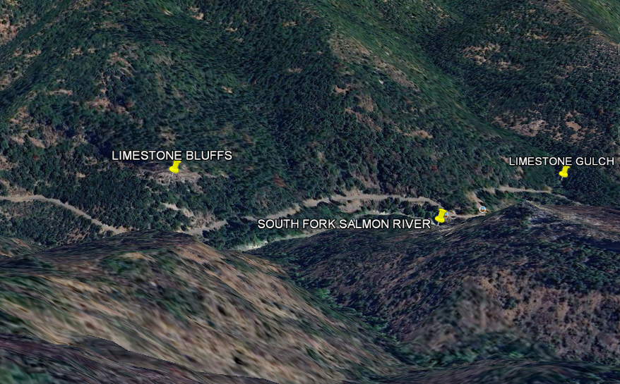
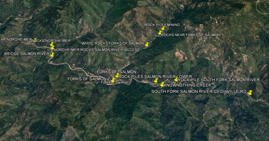
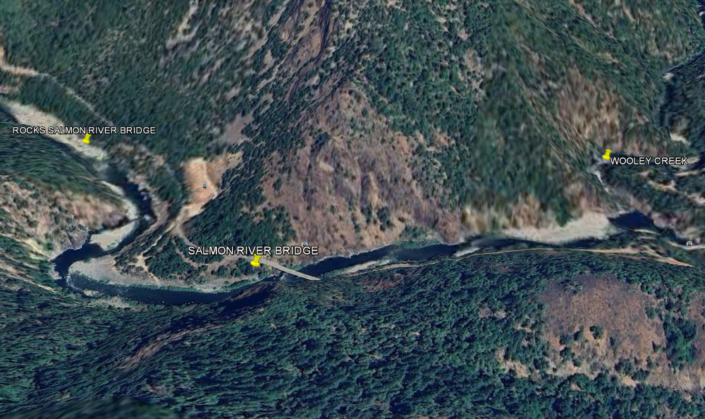
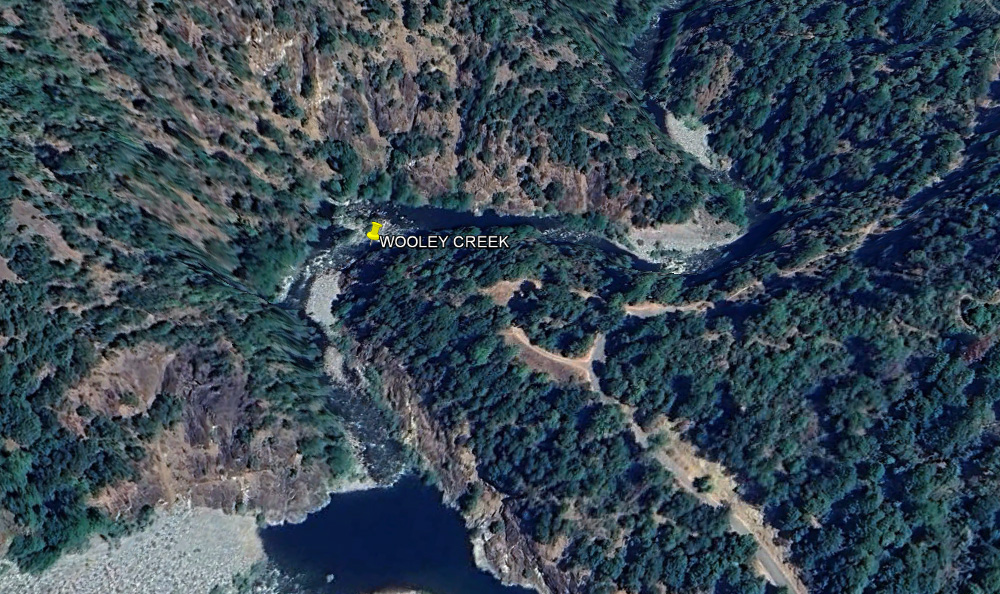
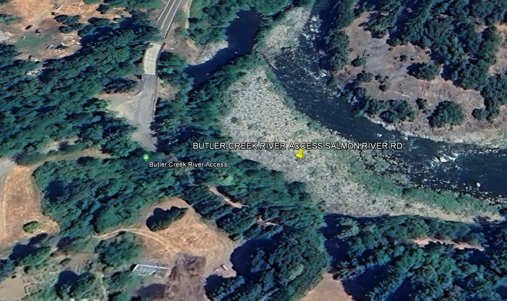
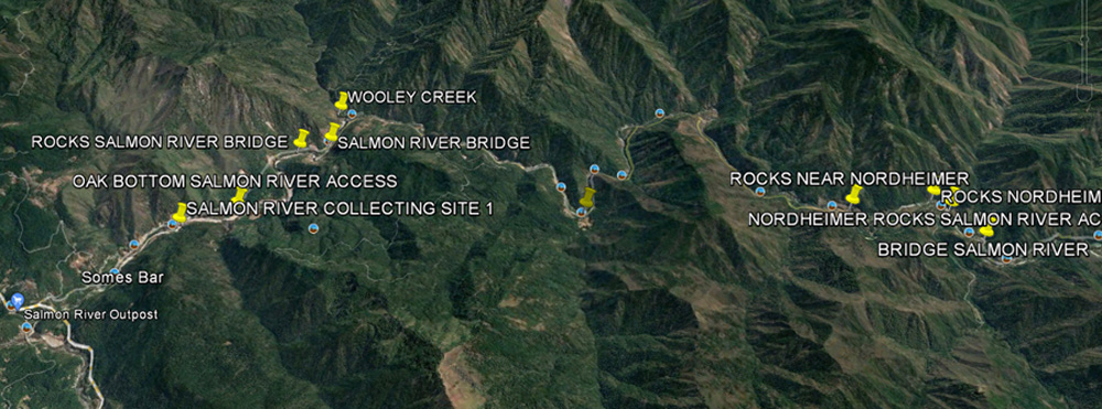
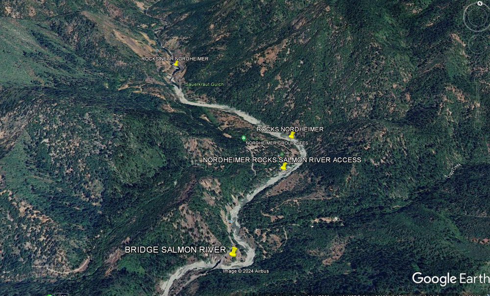
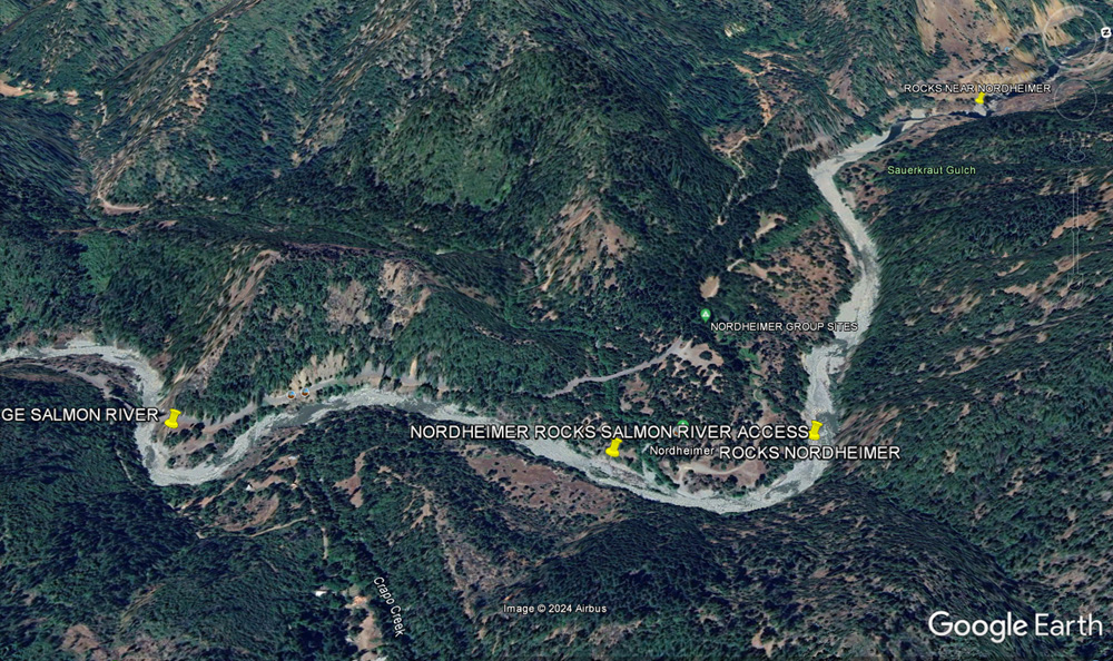
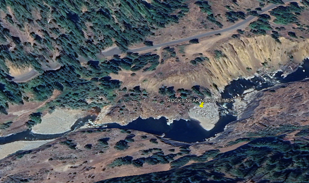
SALMON RIVER
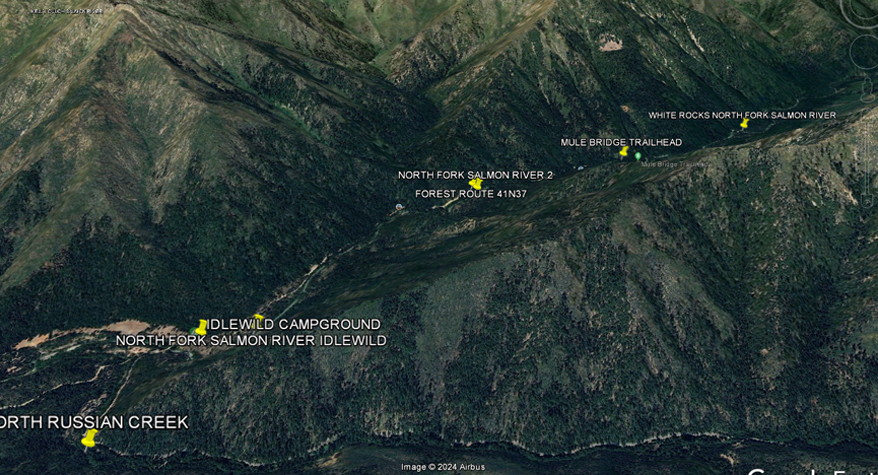
SALMON RIVER ROAD
NORDHEIMER SALMON RIVER
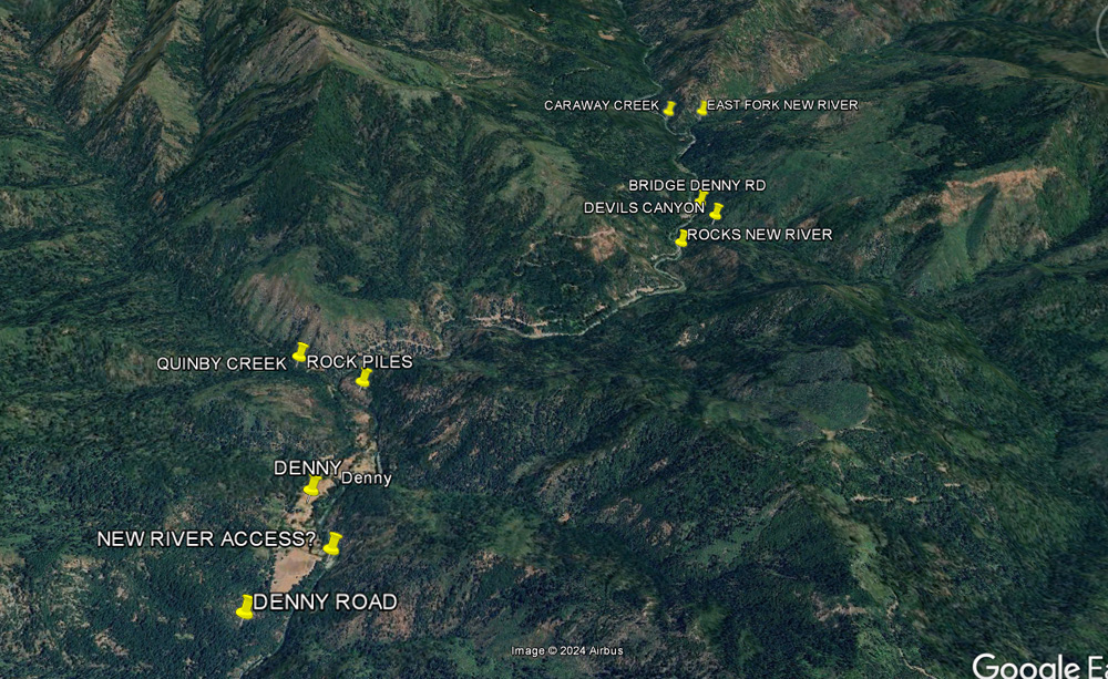
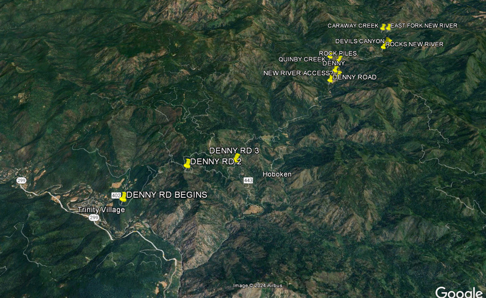
NEW RIVER AT DENNY
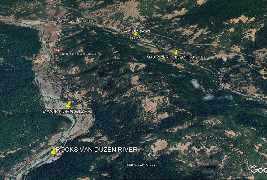
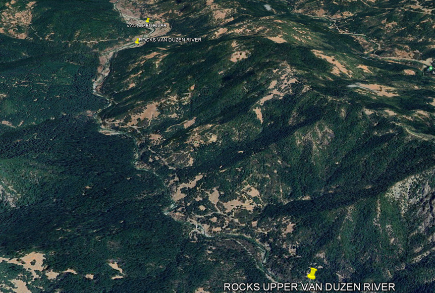
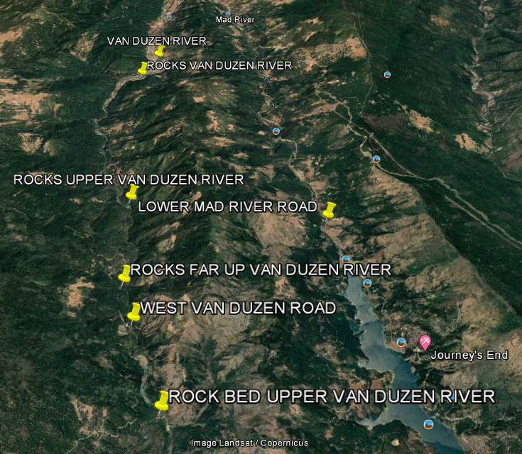
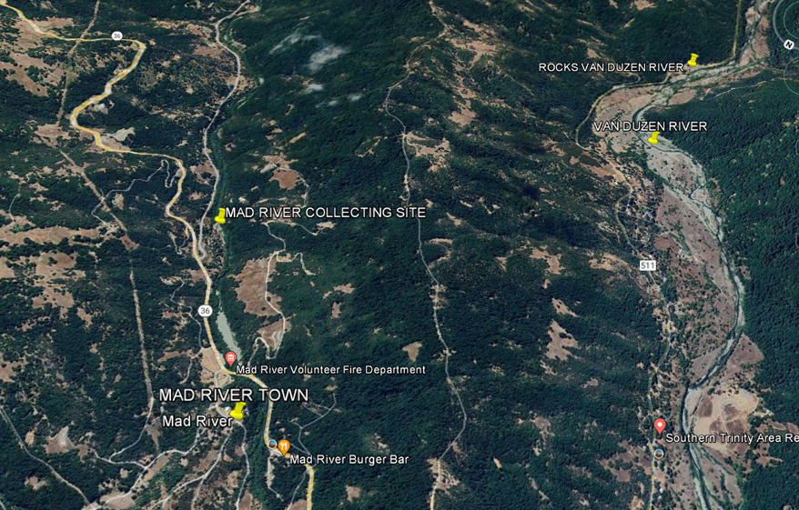
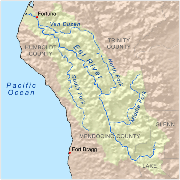
VAN DUZEN
RIVER
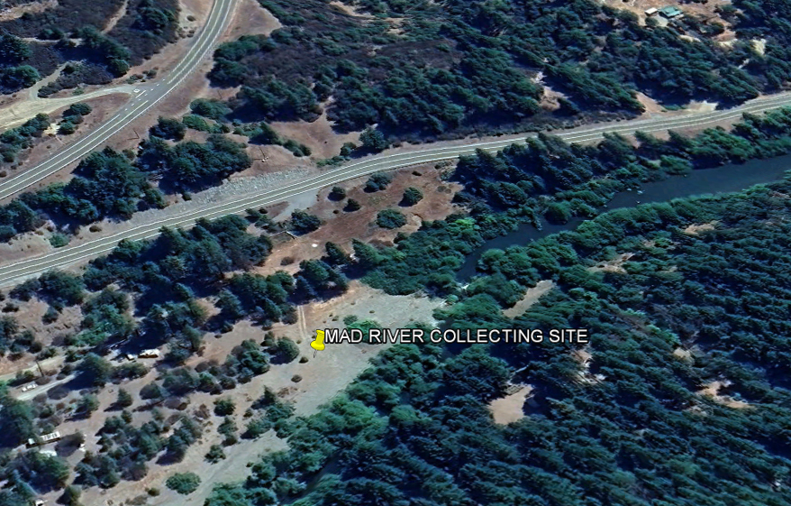
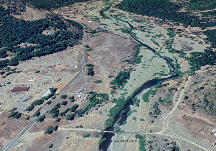
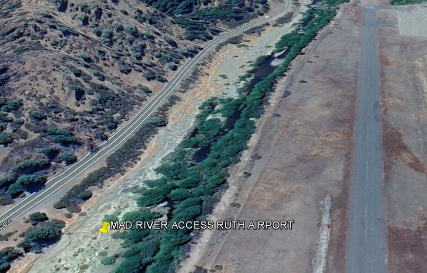
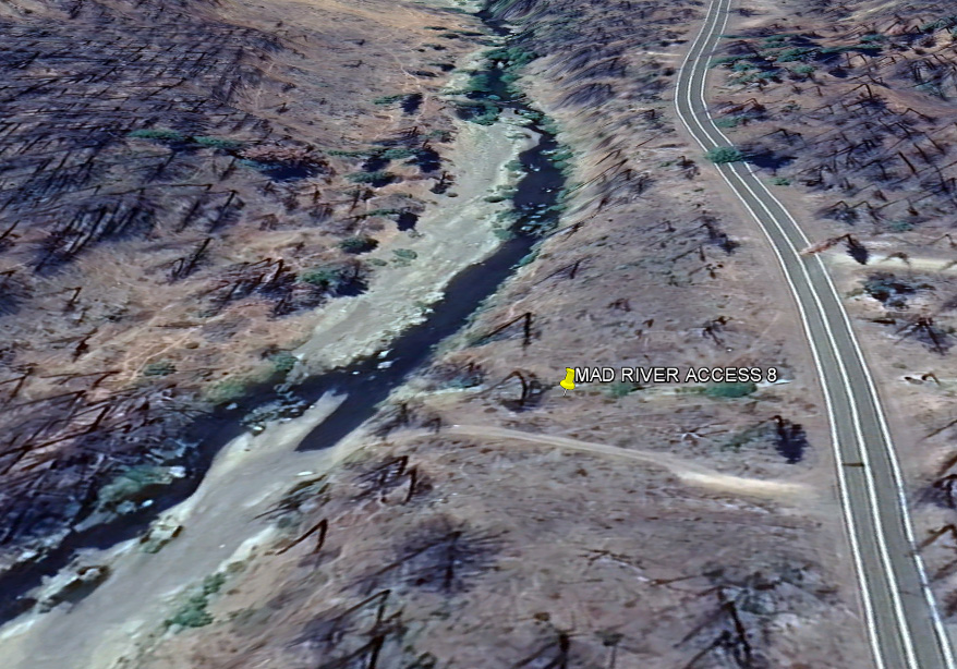
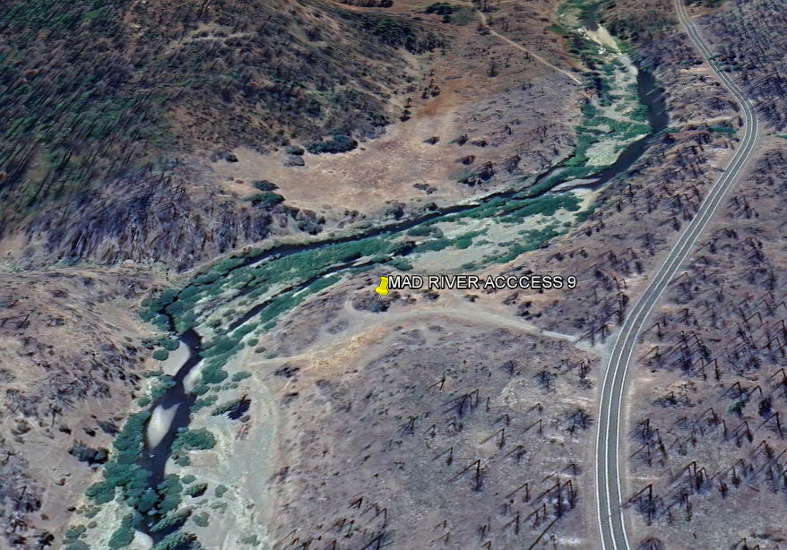
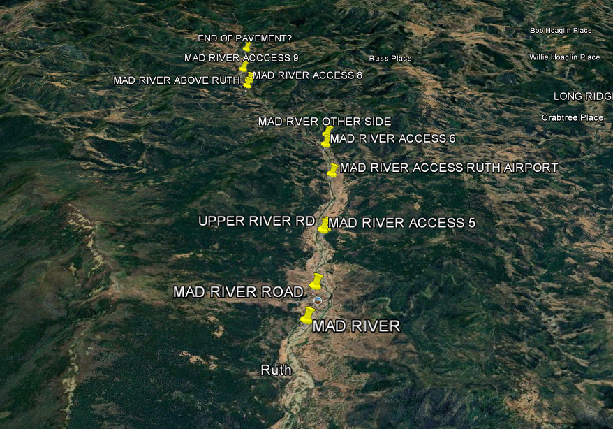
MAD RIVER
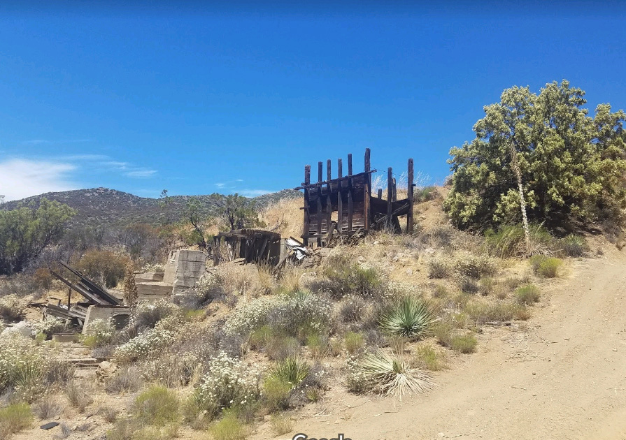
HALE CREEK MINE, MAD RIVER
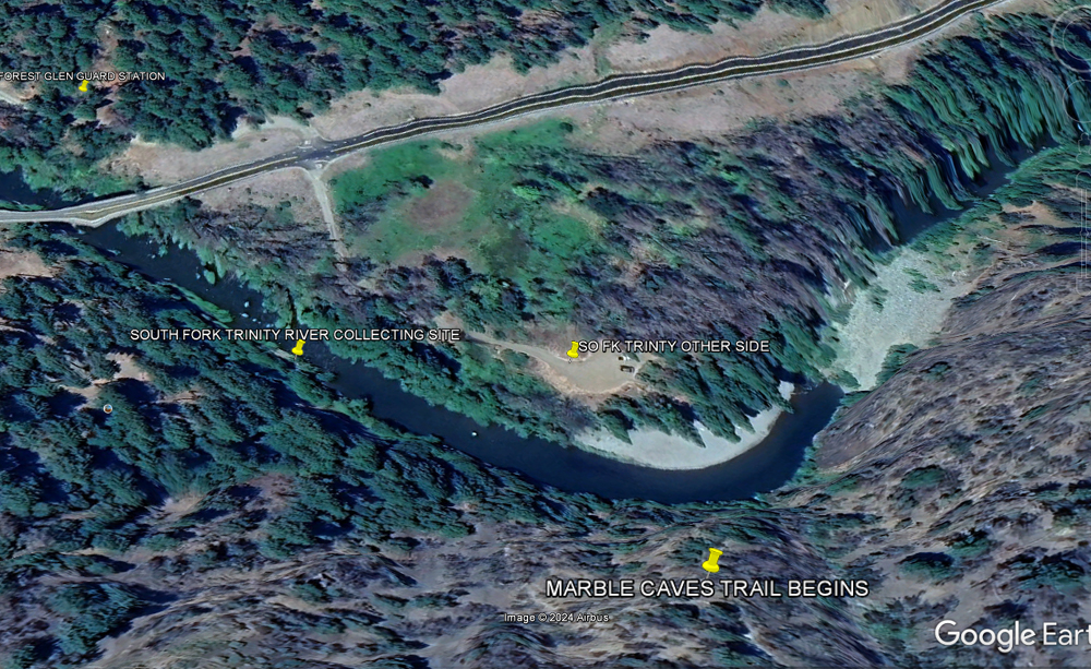
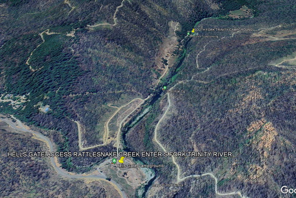
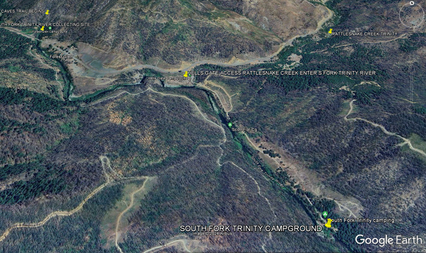
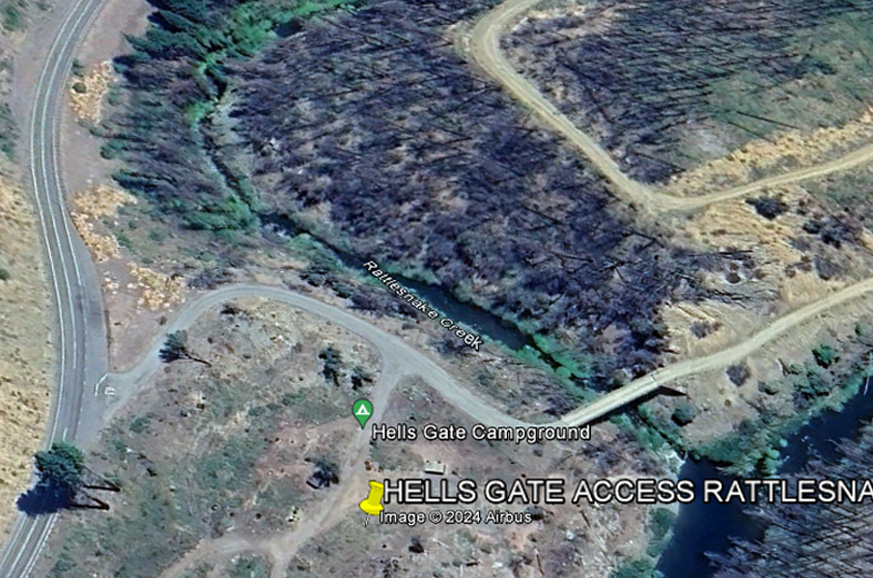
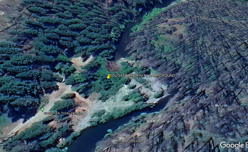
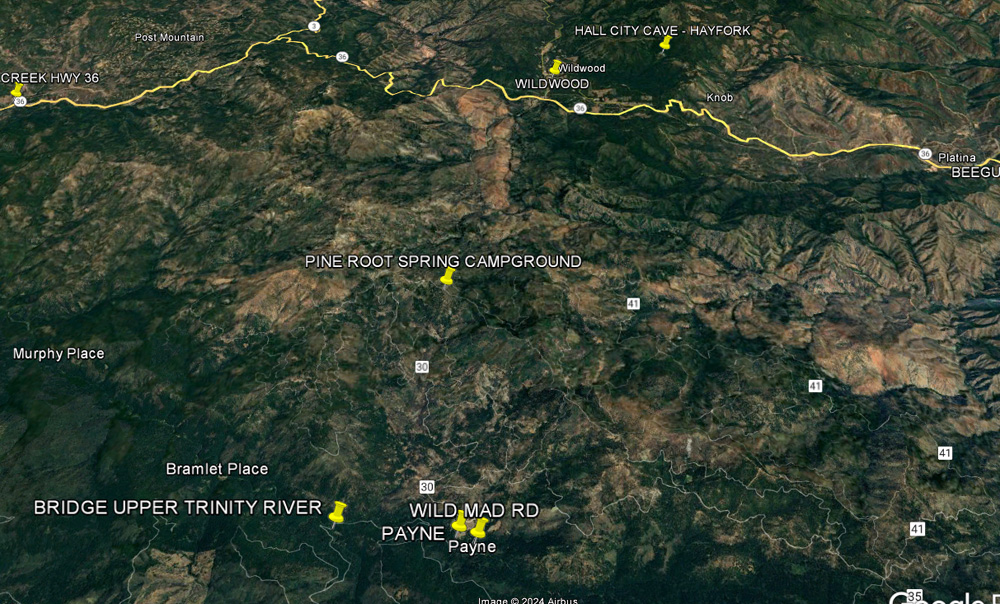
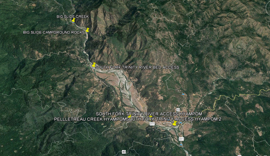
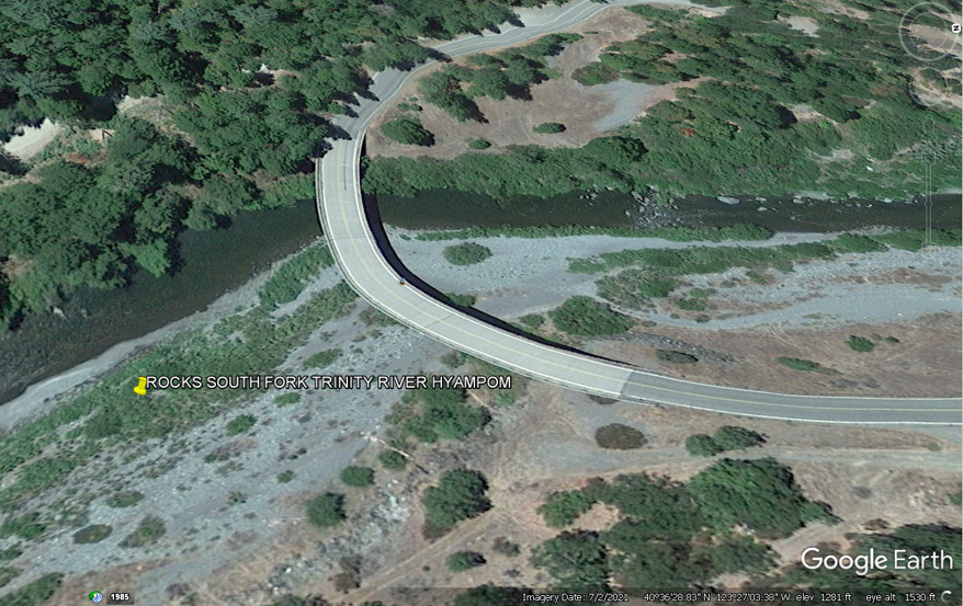
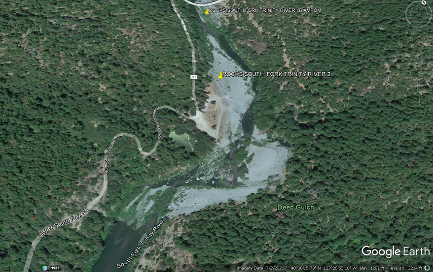
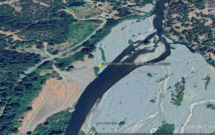
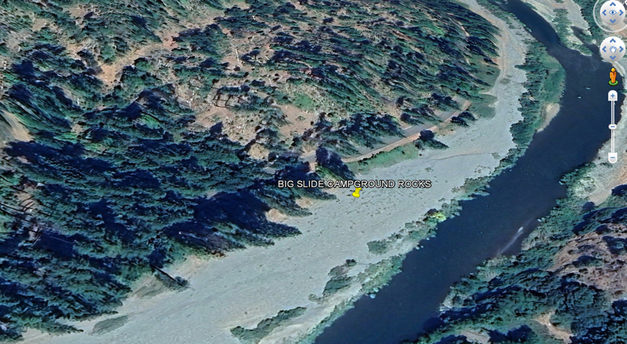
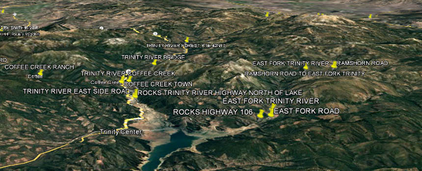
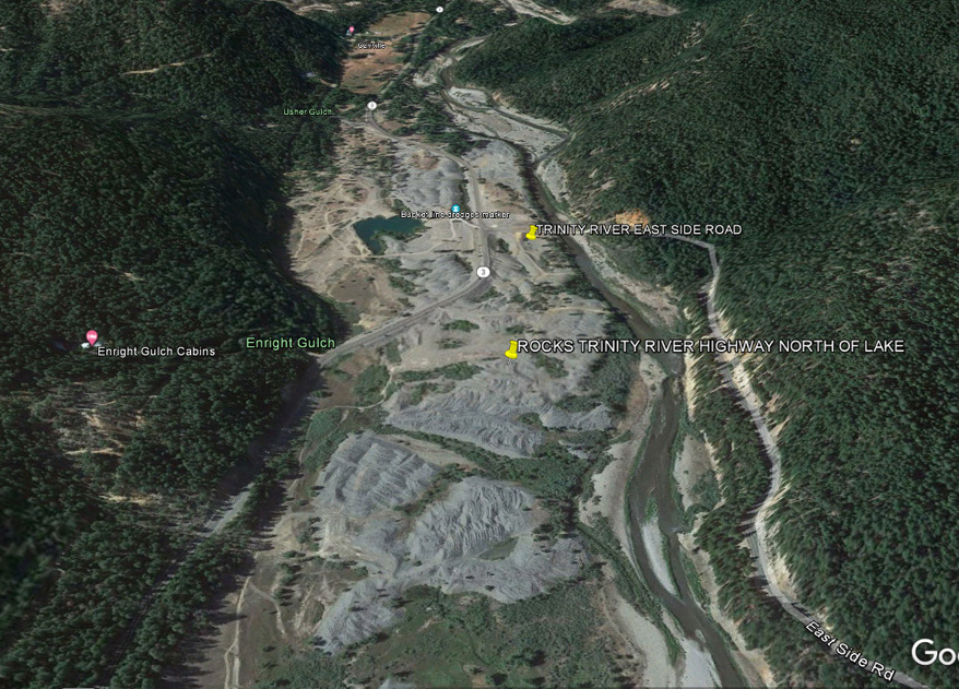
NORTHERN ZONE Hellgate Area Trinity River Highway 299 ----------------------------------- SOUTH FORK TRINITY RIVER
Hell Gate to Marble Caves
FOREST GLEN CABIN GUARD STATION?
FOREST GLEN
RATTLESNAKE
CREEK
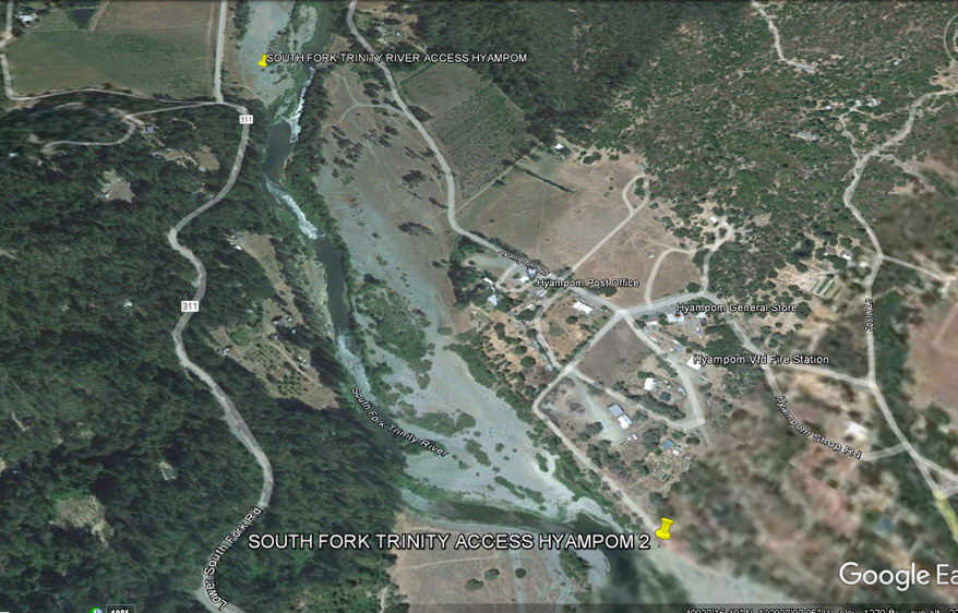
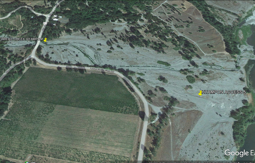
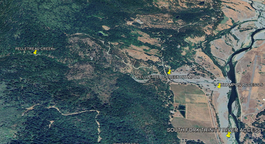
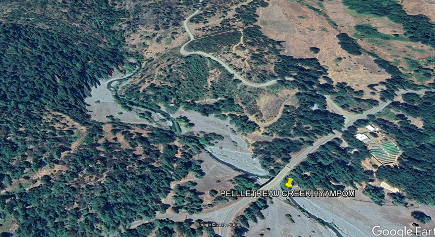
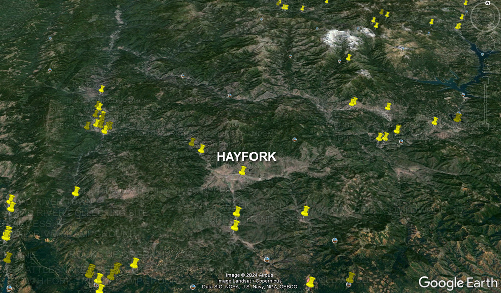
HYAMPOM
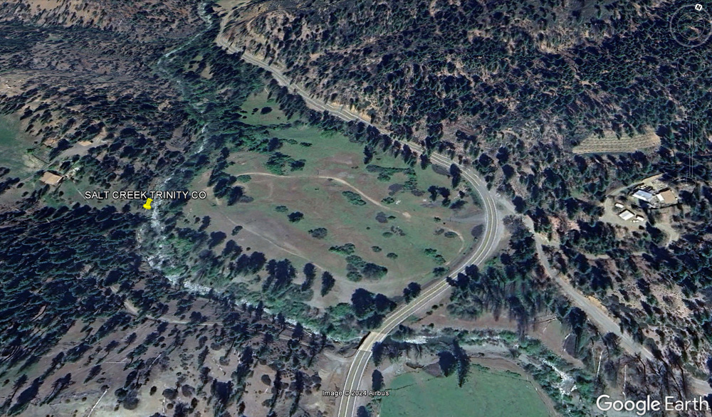
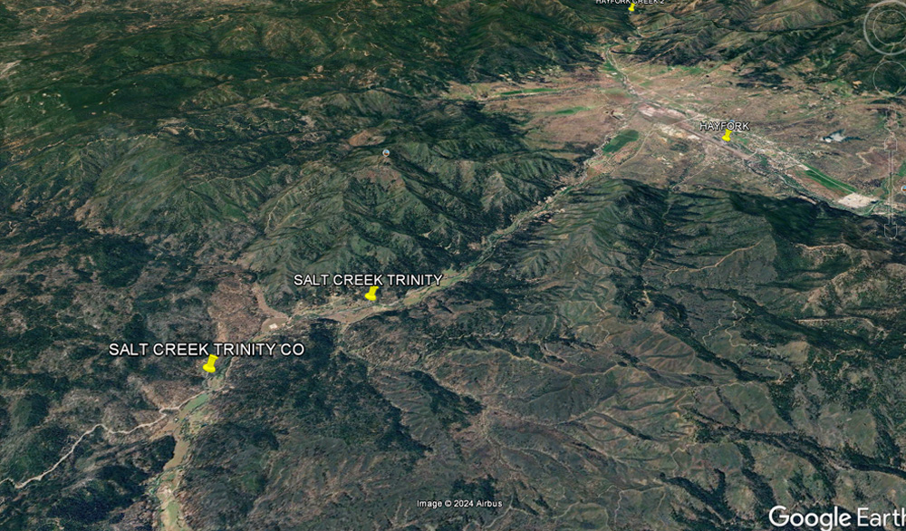
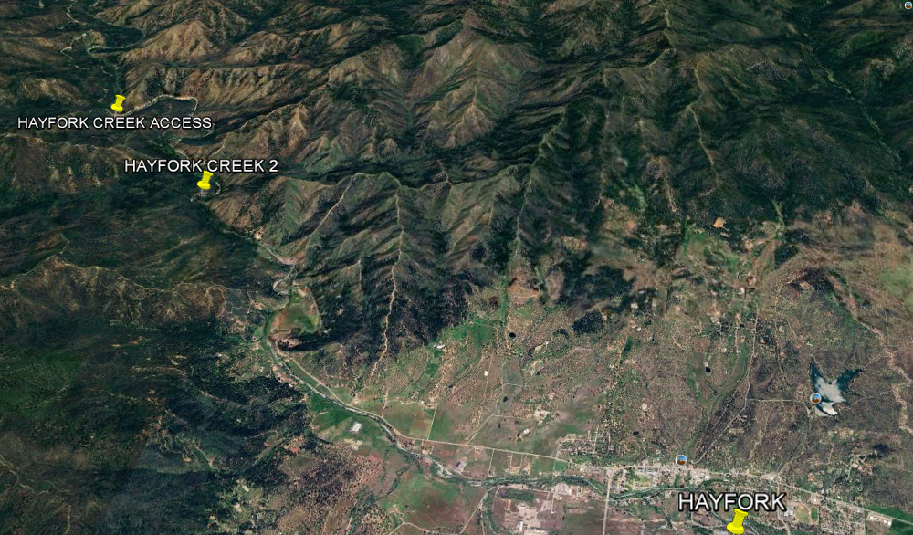
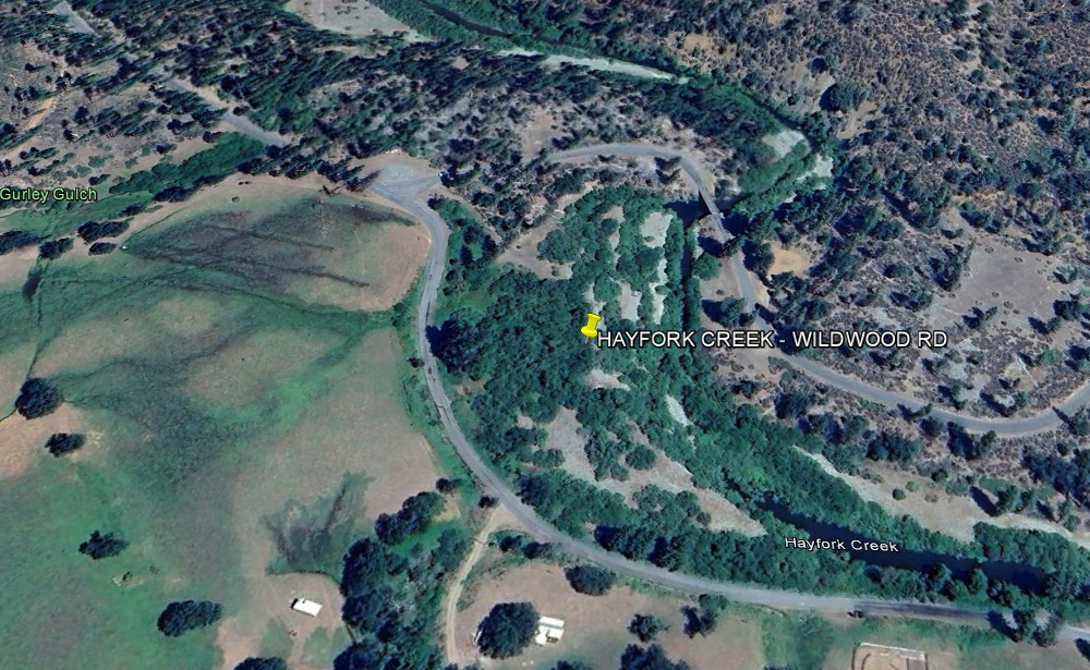
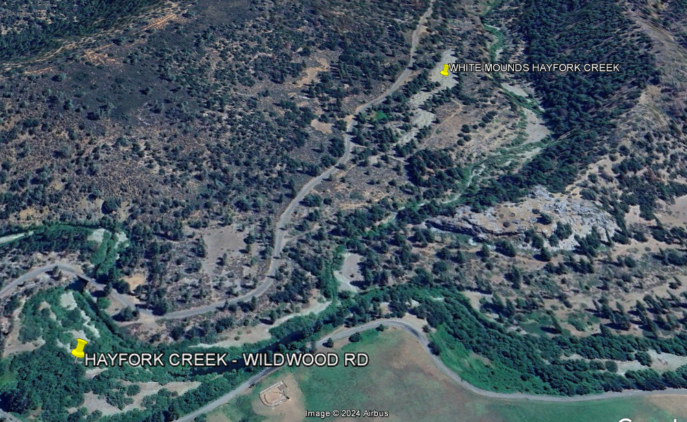
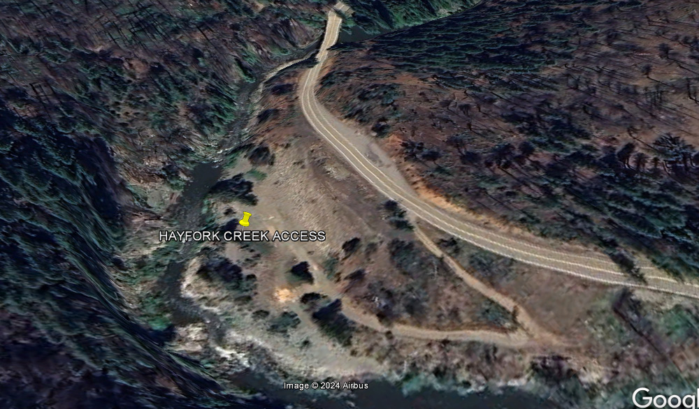
HAYFORK SALT CREEK
HAYFORK
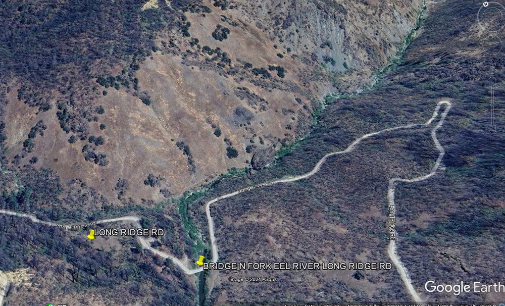
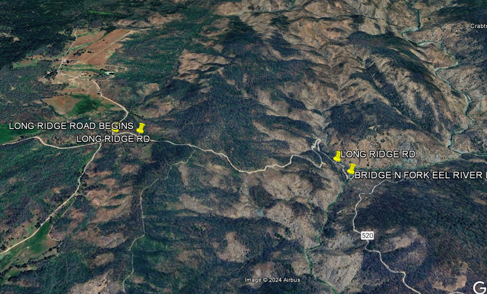
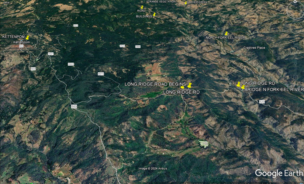
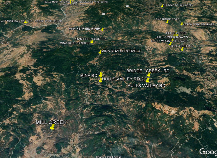
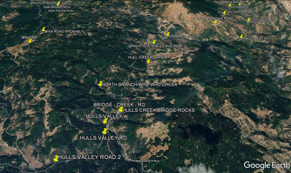
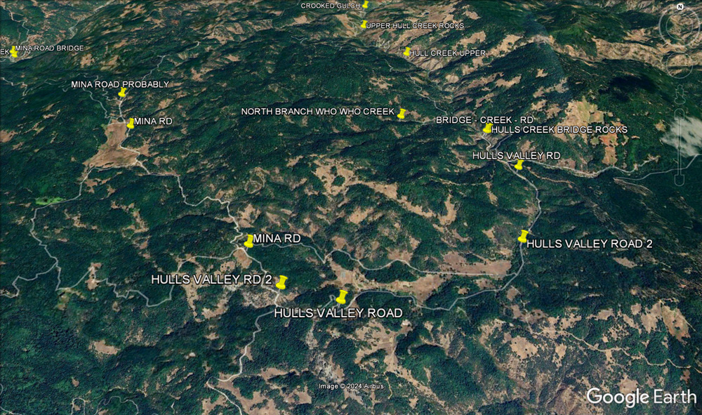
KETTENPOM - NORTH FORK EEL RIVER
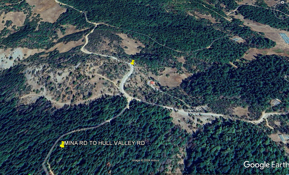
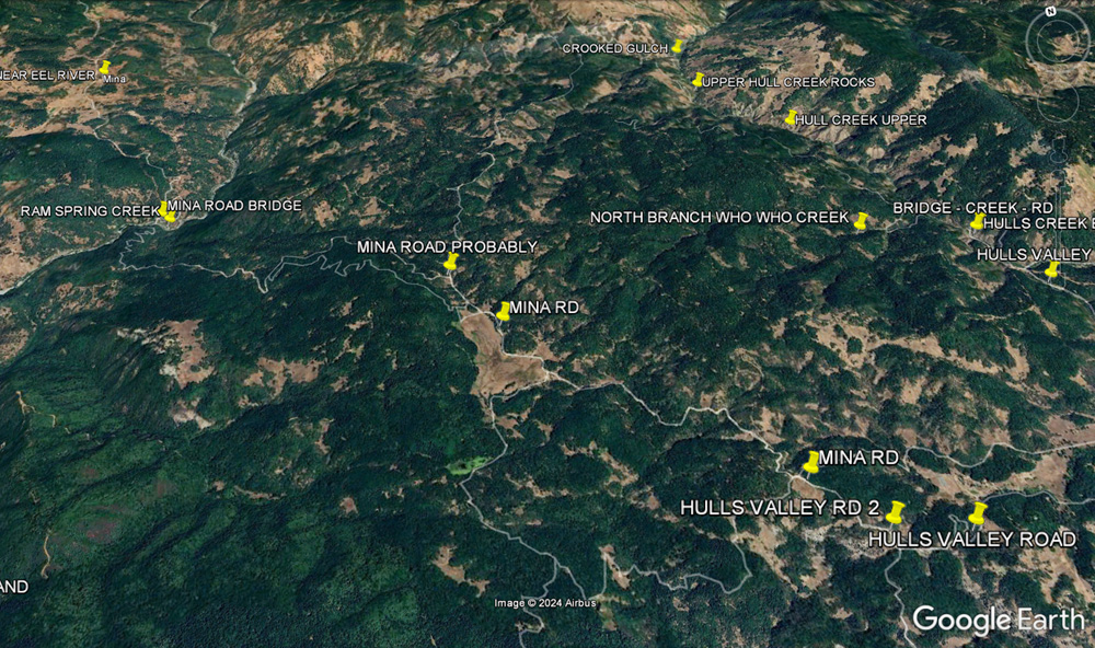
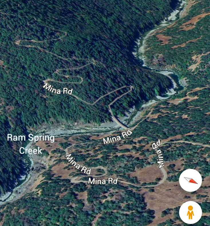
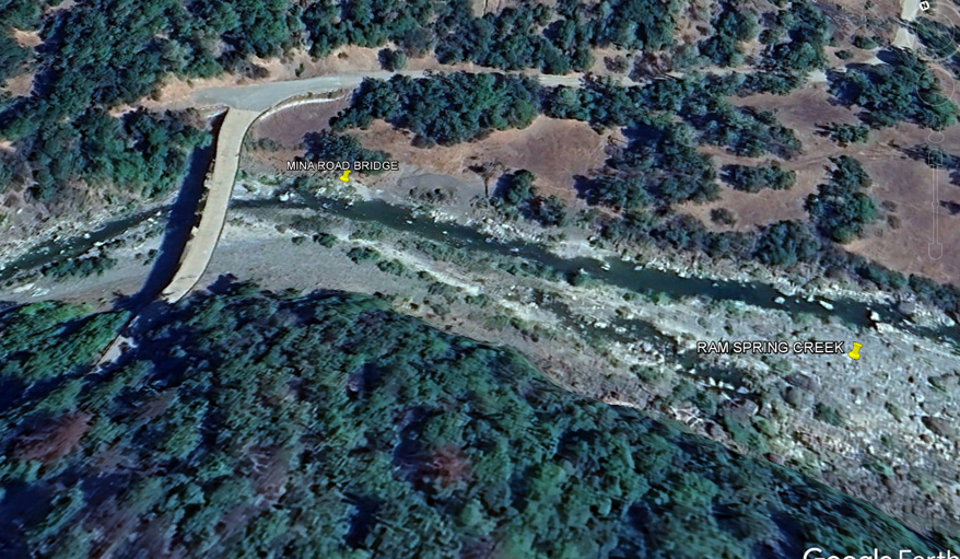
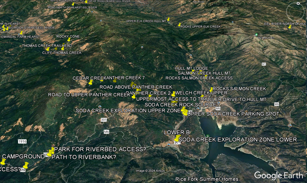
HULL CREEK - MINA ROAD MINA RD-RAM SPRINGS CREEK
RAM SPRINGS CREEK 8 MILES NORTH OF COVELO
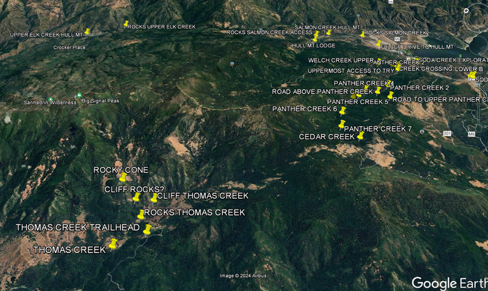
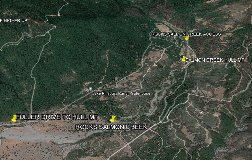
SALMON CREEK HULL MOUNTAIN
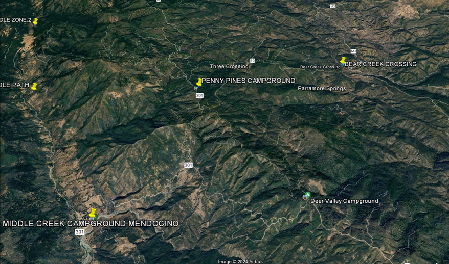
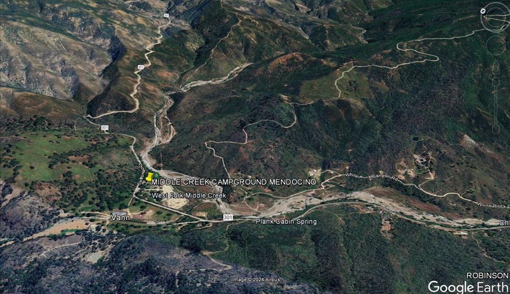
Southern approach to Lake Pillsbury from Clear Lake North of Clear Lake-Elk Mt. Rd-West Fork Middle Creek
M3 ROUTE EAST
OF PILLSBURY - DIFFICULT MAYBE
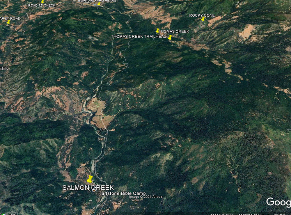
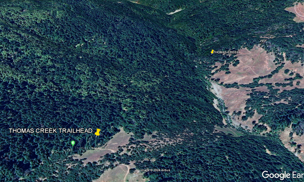
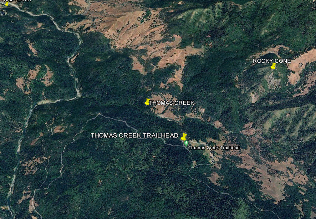
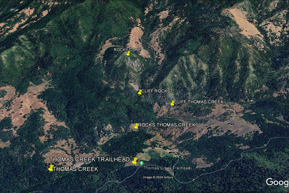
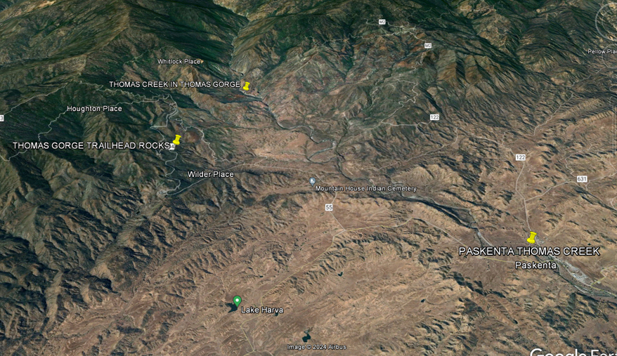
THOMAS CREEK TRAILHEAD
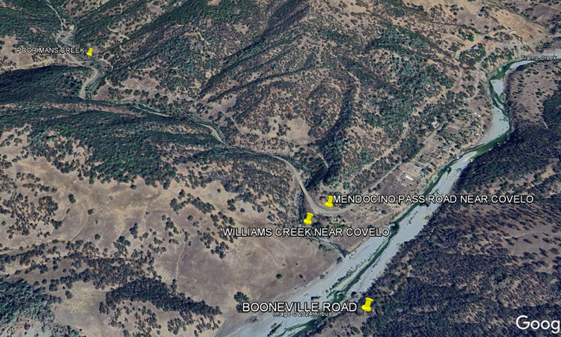
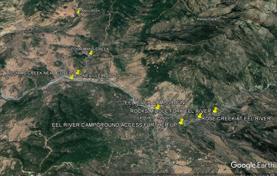
Mendocino Pass Rd - Poor Man's Creek-Williams Creek
Eel River-Black Butte River Resort-Van Horn Creek Eden Valley creeks Hammerhorn-Middle Eel Elk Creek
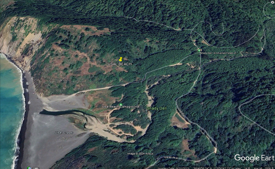
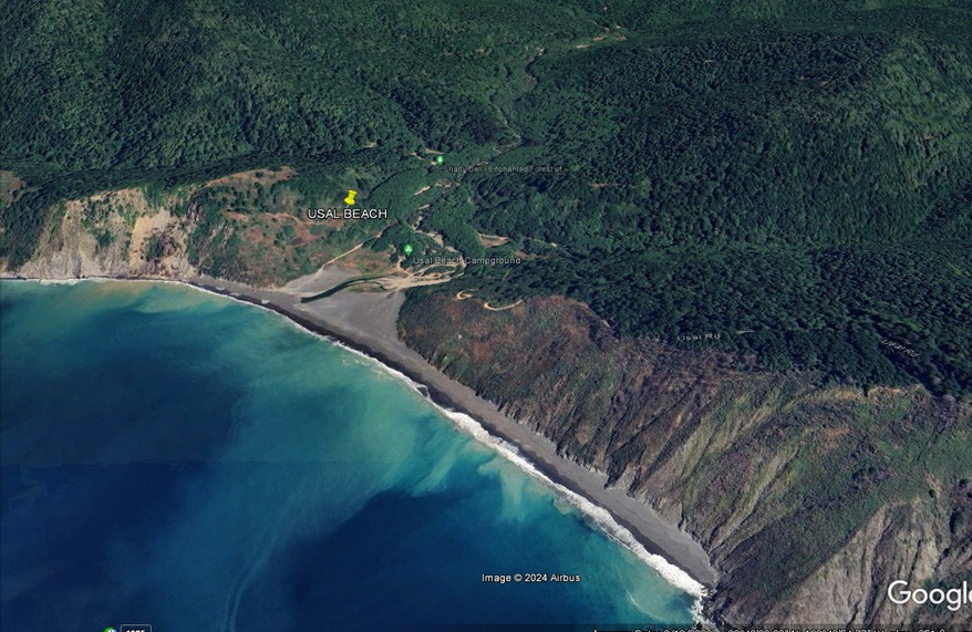
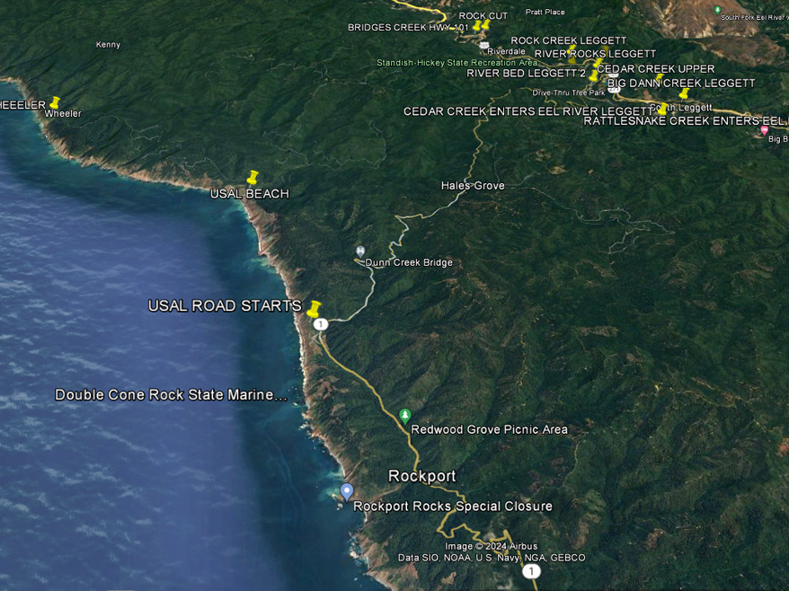
USAL BEACH
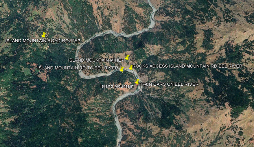
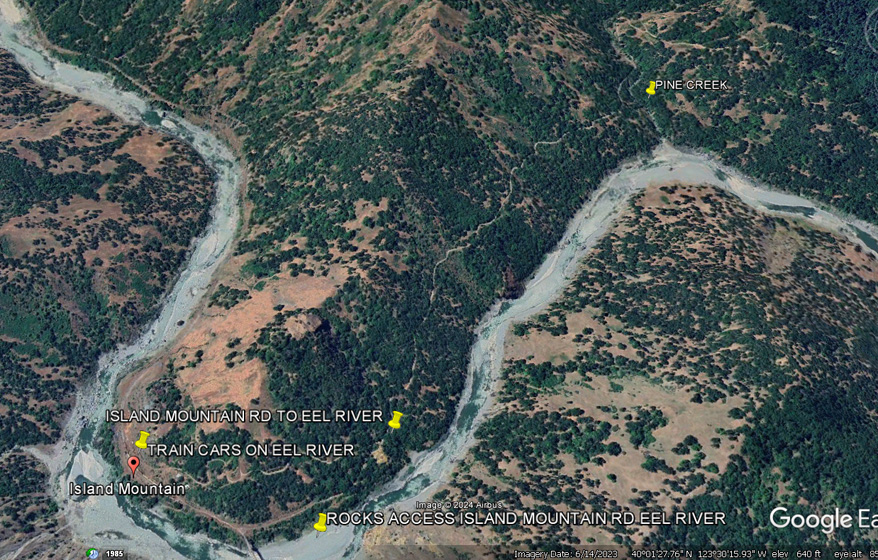
ISLAND MOUNTAIN - Probably inaccessible by road
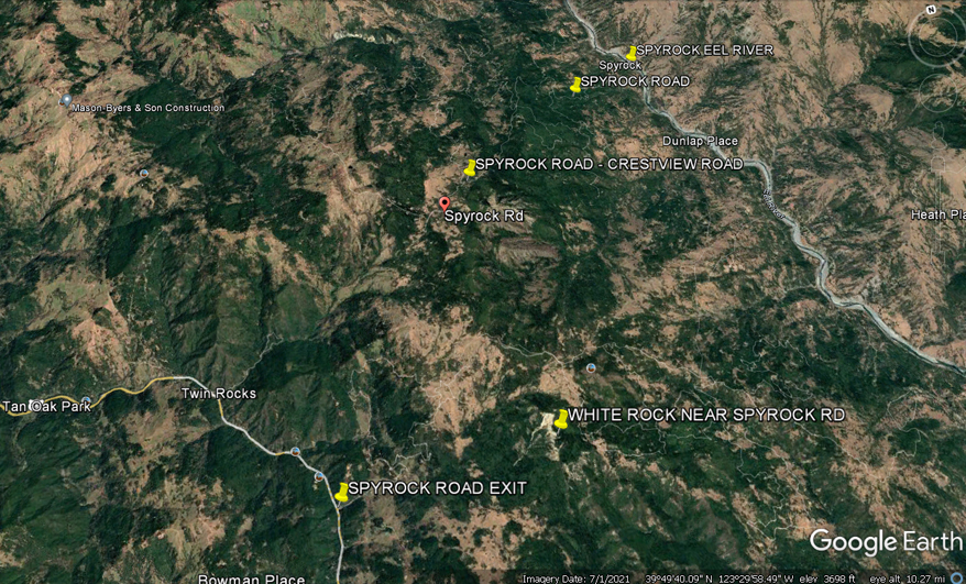
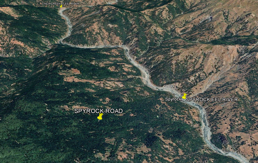
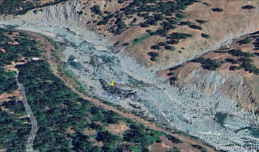
SPYROCK RD
Eel River-Black
Butte River Resort-Van Horn Creek 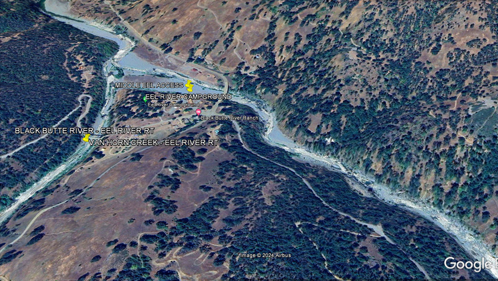
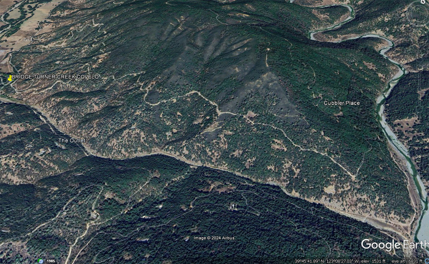
COVELO EEL RIVER
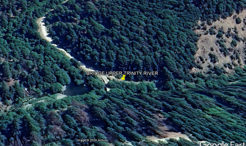
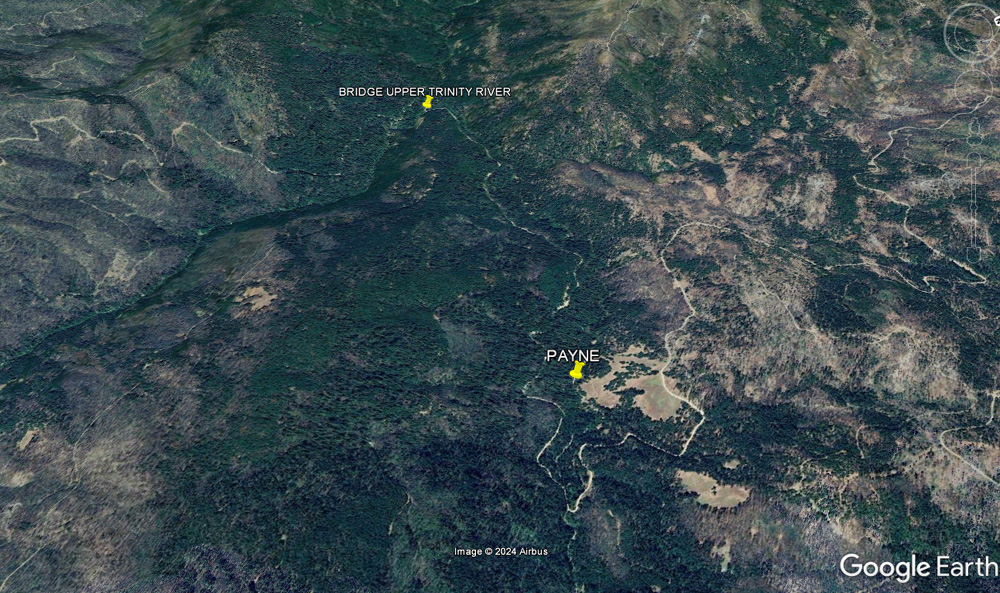
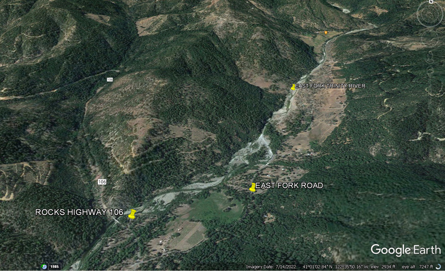
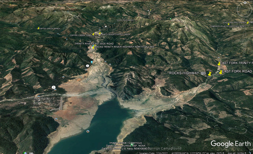
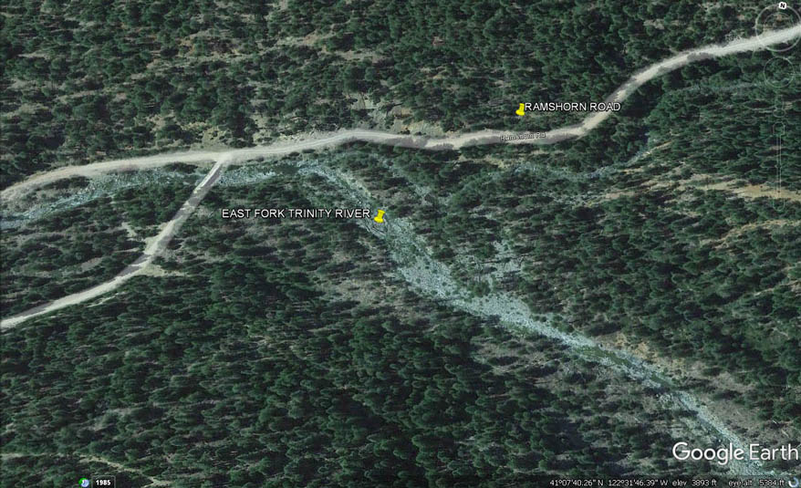
UPPER TRINITY RIVER ABOVE LAKE
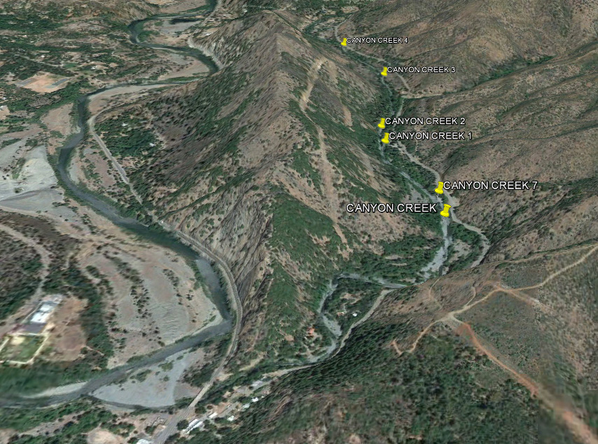
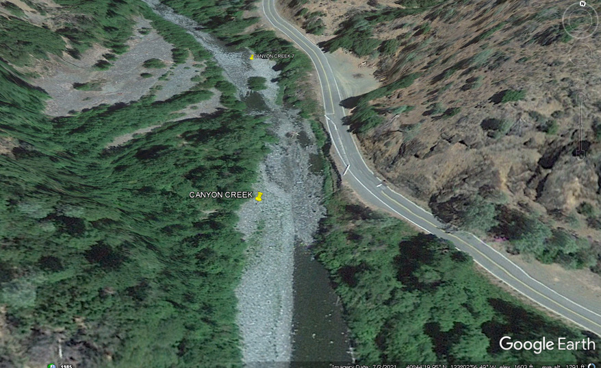
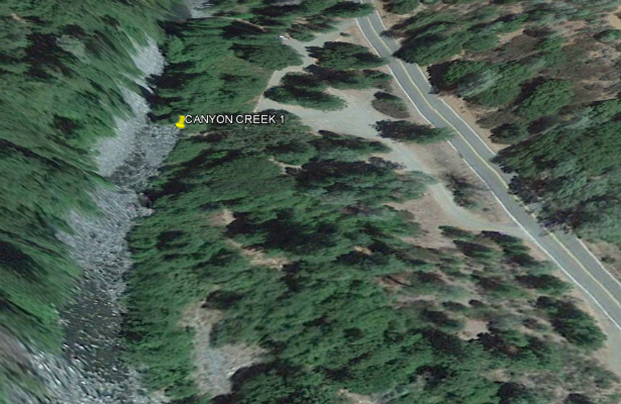
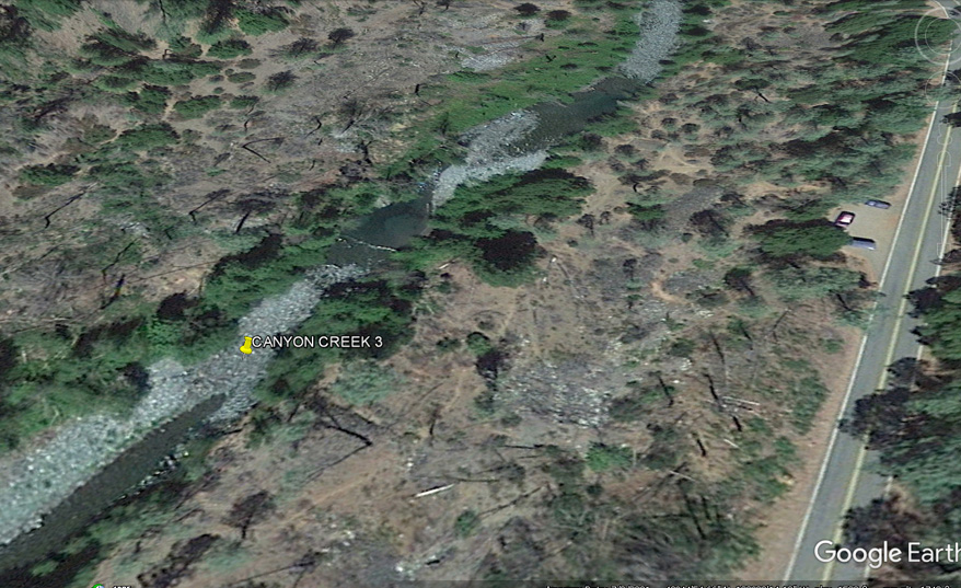
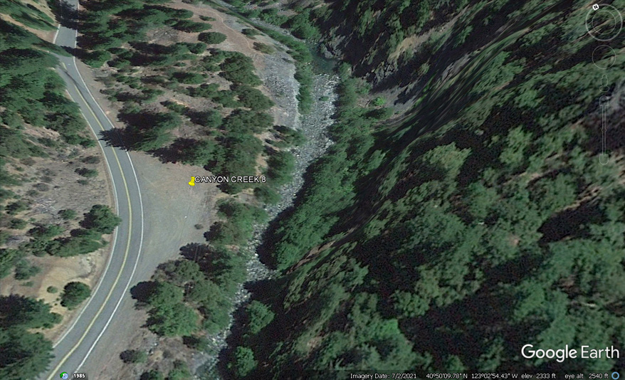
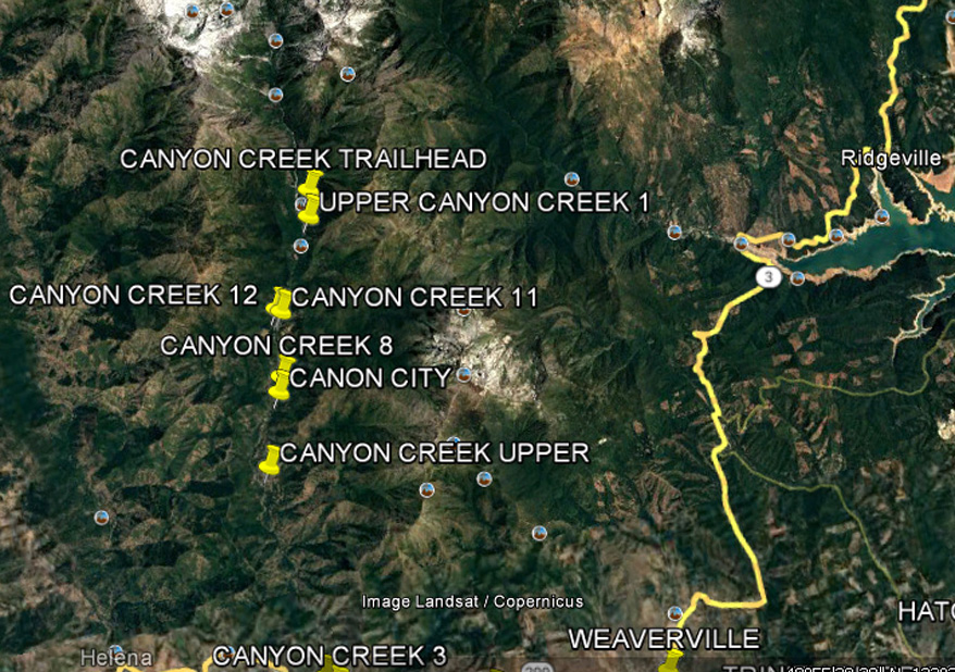
CANYON CREEK
UPPER TRINITY RIVER TWO FORKS AREA
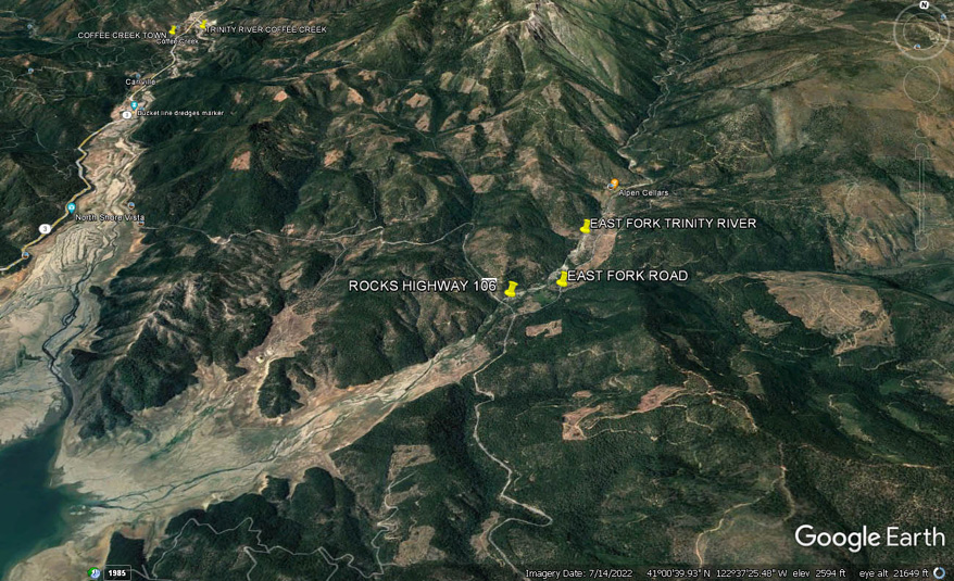
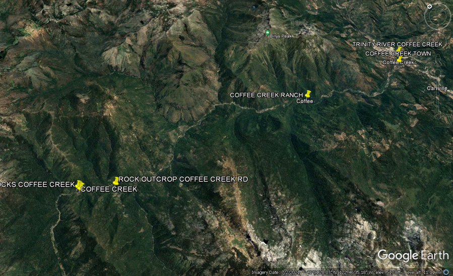
COFFEE CREEK
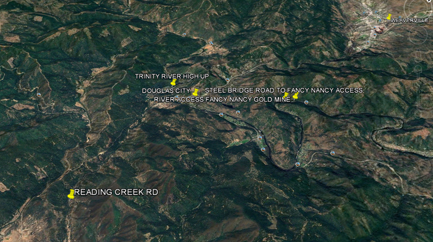
READING CREEK
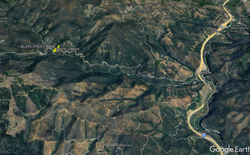
SLATE CREEK
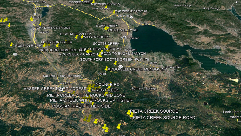
SOUTHERN ZONE - LAKE COUNTY 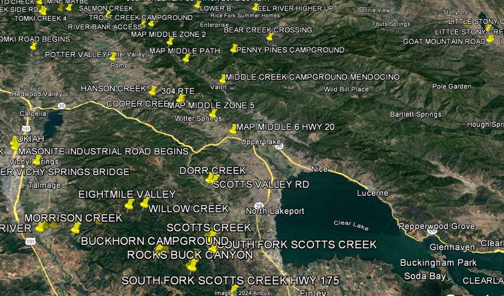
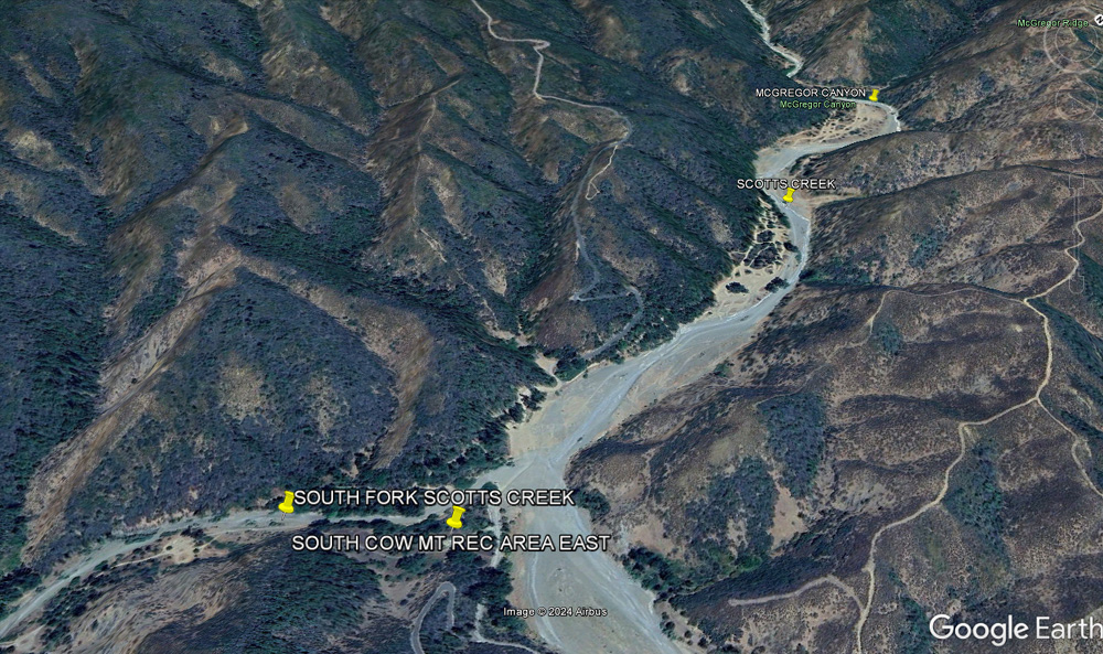
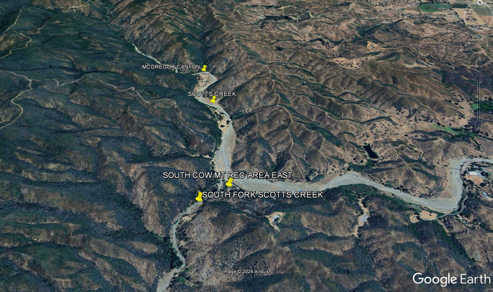
Cow Mountain to Scott Creek, west of Clear Lake - Uncertain
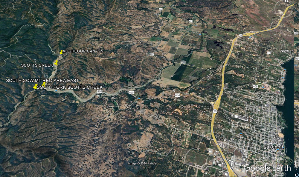
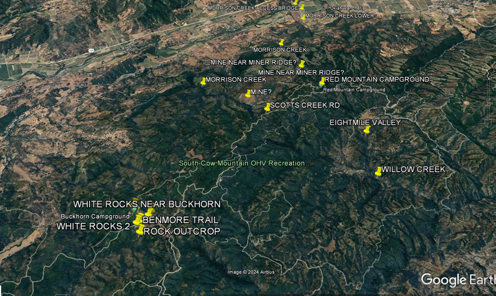
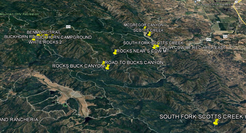
SCOTTS CREEK
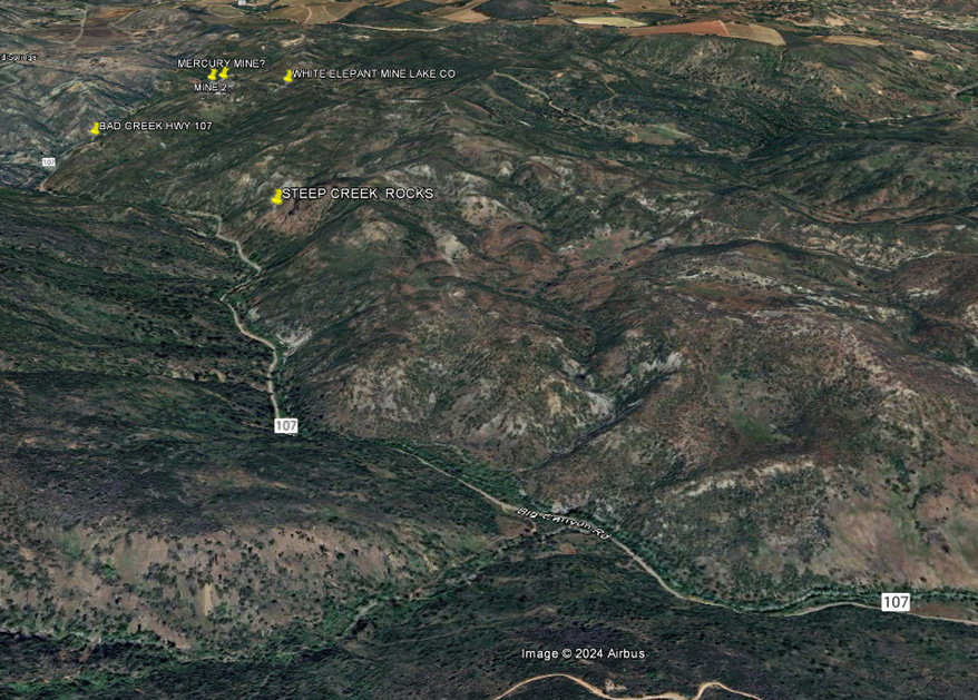
Bad Creek-Big Canyon Road
North of Clear Lake-Elk Mt. Rd-West Fork Middle Creek Southern approach to Lake Pillsbury from Clear Lake?
EASTERN ZONE
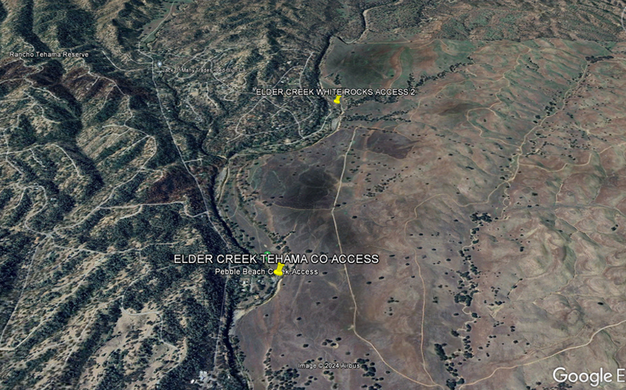
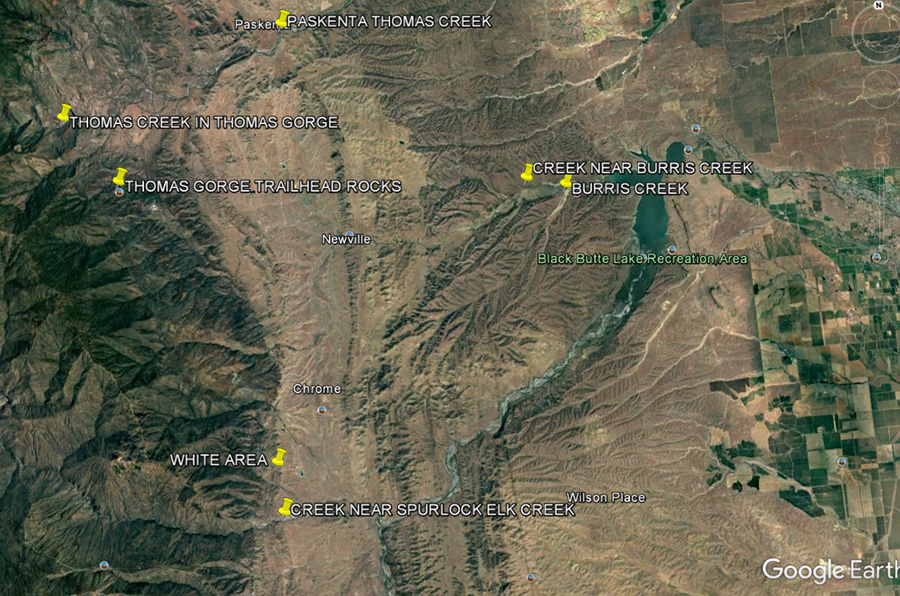
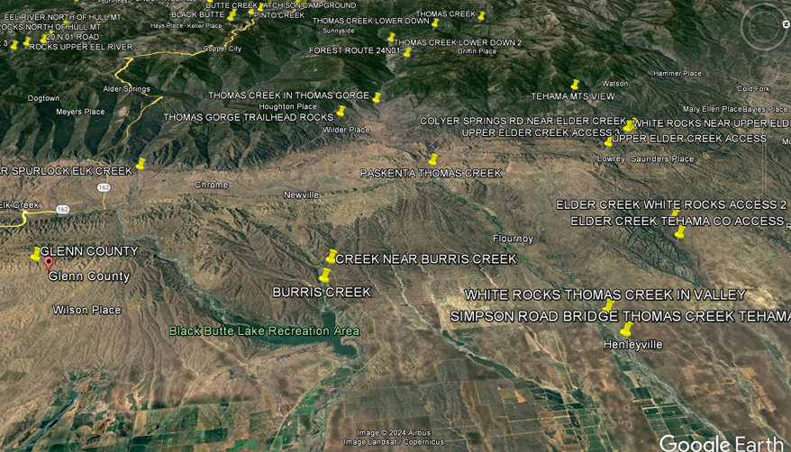
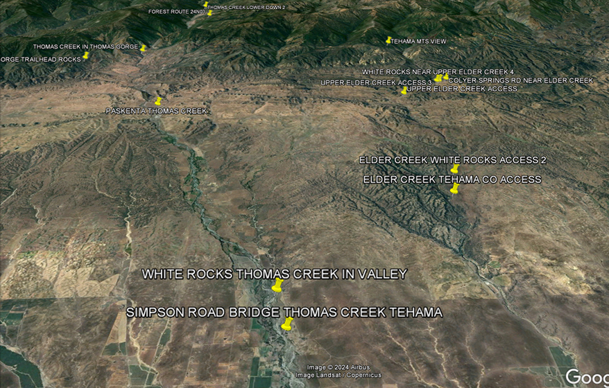
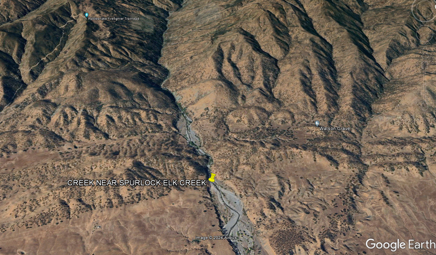
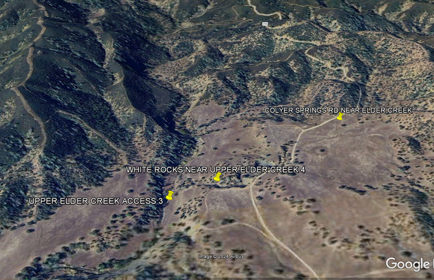
GLENN & TEHAMA THOMAS CREEK - BURRIS CREEK
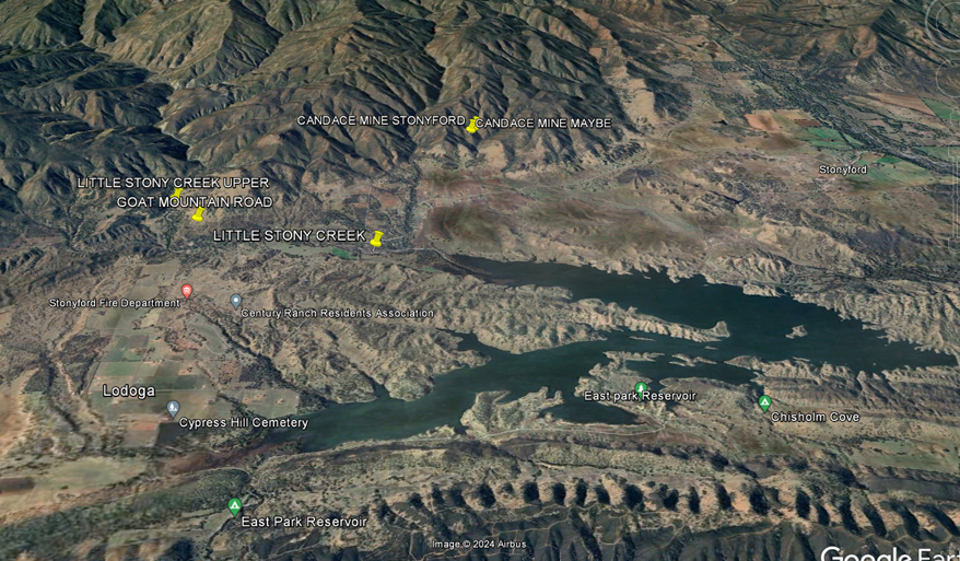
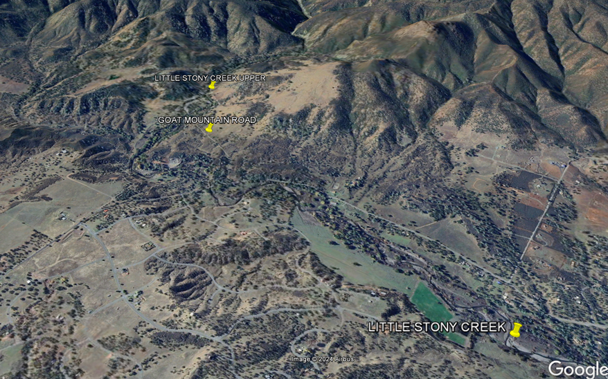
Little Stony Creek on Goat Mountain Road
|


|
|
|
|
| CALIFORNIA MINDAT |
| Mines in the Western United States – Western Mining History |
| CALIFORNIA MINES - WESTERN MINING HISTORY |
| MINERALS OF CALIFORNIA - Tiger Minerals |
| California Minerals - Marin Minerals |
| California Crystal Collection |
| Idrialite California Locations List |
|
Zircon California Locations List
|
| Atolia Mining District |
| Red Rock Canyon prospects - SEE KERN COUNTY |
|
|
|
Barite, Calcite, Cerussite, Hedyphane, Inyoite, Mimetite, Opal var Hyalite, Sphalerite, Wulfenite |
|
LEISER RAY MINE NEAR TUNGSTEN FLAT ANGELSITE, CALCITE, CERUSSITE, GYPSUM, LEADHILLITE, MIMETITE, PYROMORPHITE, SPHALERITE, VANADANITE |
| Rockhounding Map |
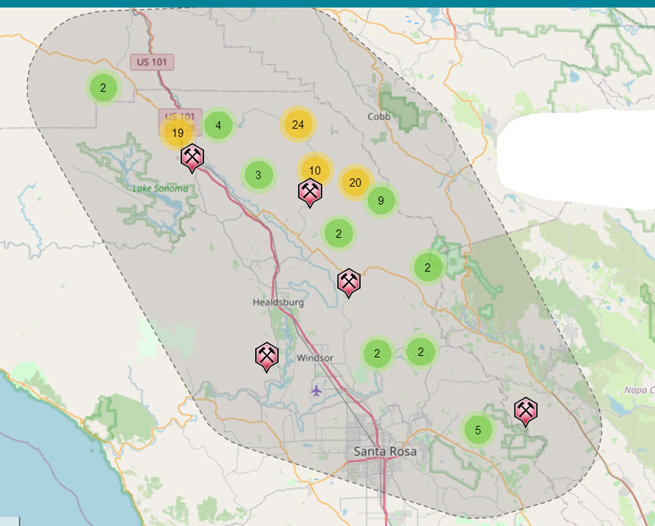
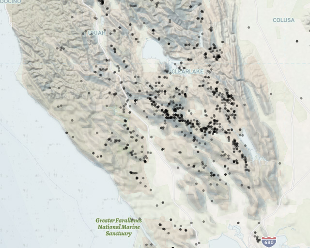
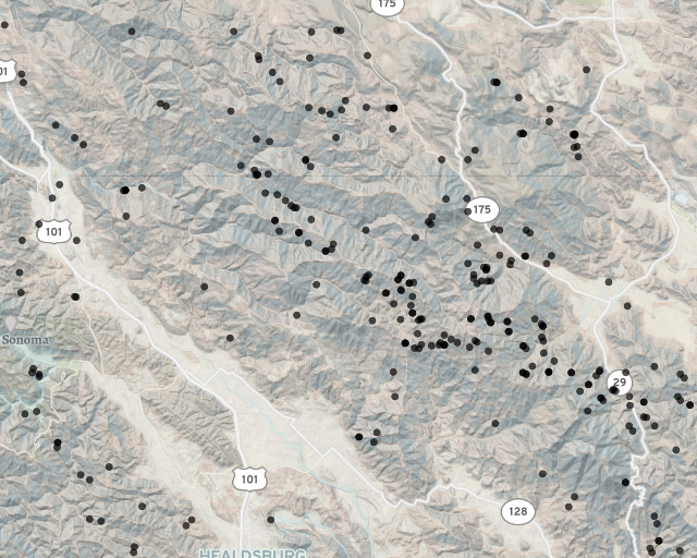
| Mendocino County, California Mines |
| Mines and mineral resources of Mendocino County |
|
Laytonville Quarry, Laytonville Albite, Apatite, Aragonite, Calcite, Clinozoisite, Garnet Group, Kutnohorite, Talc, Titanite,Tremolite |
| Layton Quarry Rockhounding |
|
Rosenhahnite occurrence, Russian River, Cloverdale area Albite, Aragonite, Calcite, Datolite, Diopside, Laumontite, Opal, Pectolite, Rosenhahnite, Xonotlite An occurrence of Rosenhahnite (type locality) 2.9 miles SSE of Pieta, along the E bank of the Russian River near Highway 101, 5 miles N of Cloverdale. NOTE: The TL of Rosenhahnite should be Pieta since that town is closer by ½ than Cloverdale, which is in another county as well. Mineralization is found in Franciscan rocks in the Russian River. |
|
Large Zoisite crystals 7.8 to 11.8 inches long have been found there Clinozoisite?
Vesuvianite Zoisite |
| EEL RIVER AT HEARST |
|
Near Pieta Mercury, Serpintine Group |
| GOLD in Mendocino County on Mindat |
|
Cinnabar, Copper, Gold, Iridium, Platinum, Zircon Hendy Woods State Park has river access Navarro River |
| RED MOUNTAIN MINING DISTRICT |